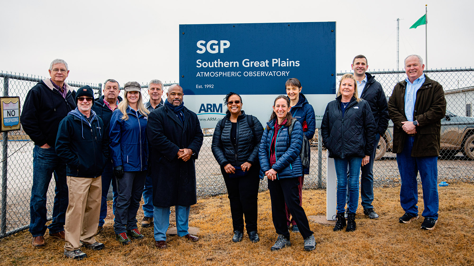
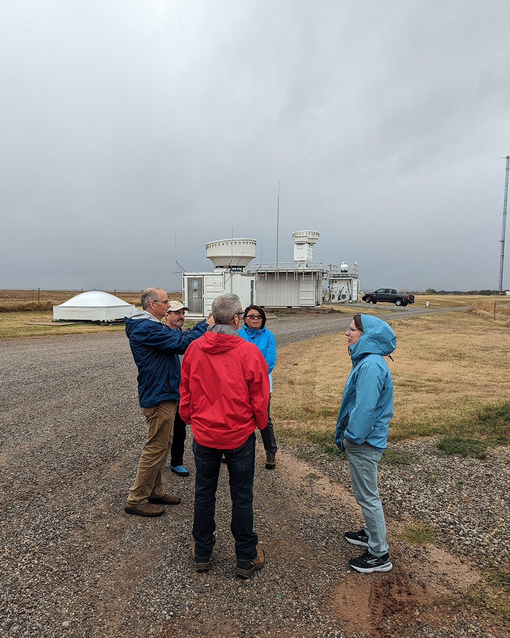
Leaders from the U.S. Department of Energy (DOE), ARM, and Argonne National Laboratory gather for a tour of the Southern Great Plains (SGP) atmospheric observatory near Lamont, Oklahoma, in January 2024. All photos are by Argonne National Laboratory.
Nestled on 160 acres of cattle pasture and wheat fields sits the heart of the Southern Great Plains (SGP) atmospheric observatory, the first field measurement site established by the U.S. Department of Energy (DOE) Atmospheric Radiation Measurement (ARM) user facility. Nine DOE national laboratories collaborate to manage ARM’s work, and DOE’s Argonne National Laboratory is responsible for the SGP and third ARM Mobile Facility (AMF3) sites.
The SGP, centered near Lamont, Oklahoma, is the world’s largest and most extensive climate research facility. Established in 1992, it currently operates around 90 ARM instruments, with year-round support for guest researchers’ instrumentation. Radars, surface meteorological instrumentation, and many other instruments make high-quality data available for atmospheric scientists worldwide through the ARM Data Center.
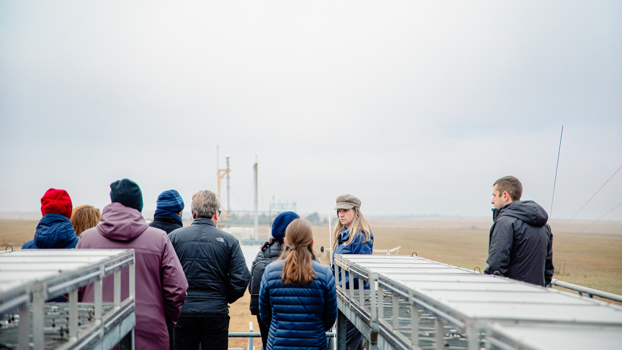
On a muddy, overcast day in January 2024, DOE Office of Science Director Asmeret Asefaw Berhe joined other DOE officials, representatives from Argonne and several other national laboratories, and ARM leaders, including DOE ARM Program Manager Sally McFarlane, for a tour of instrumentation at the SGP Central Facility. Dorothy Koch, associate director of the DOE Office of Science’s Biological and Environmental Research (BER) program, also participated in the tour.
Their day began with a crash course in ARM and the six ARM observatories, their instrumentation, how data are collected, and how they are disseminated to users. They also learned more about what activities occur at the SGP and how it supports other ARM sites, users, and field campaigns.
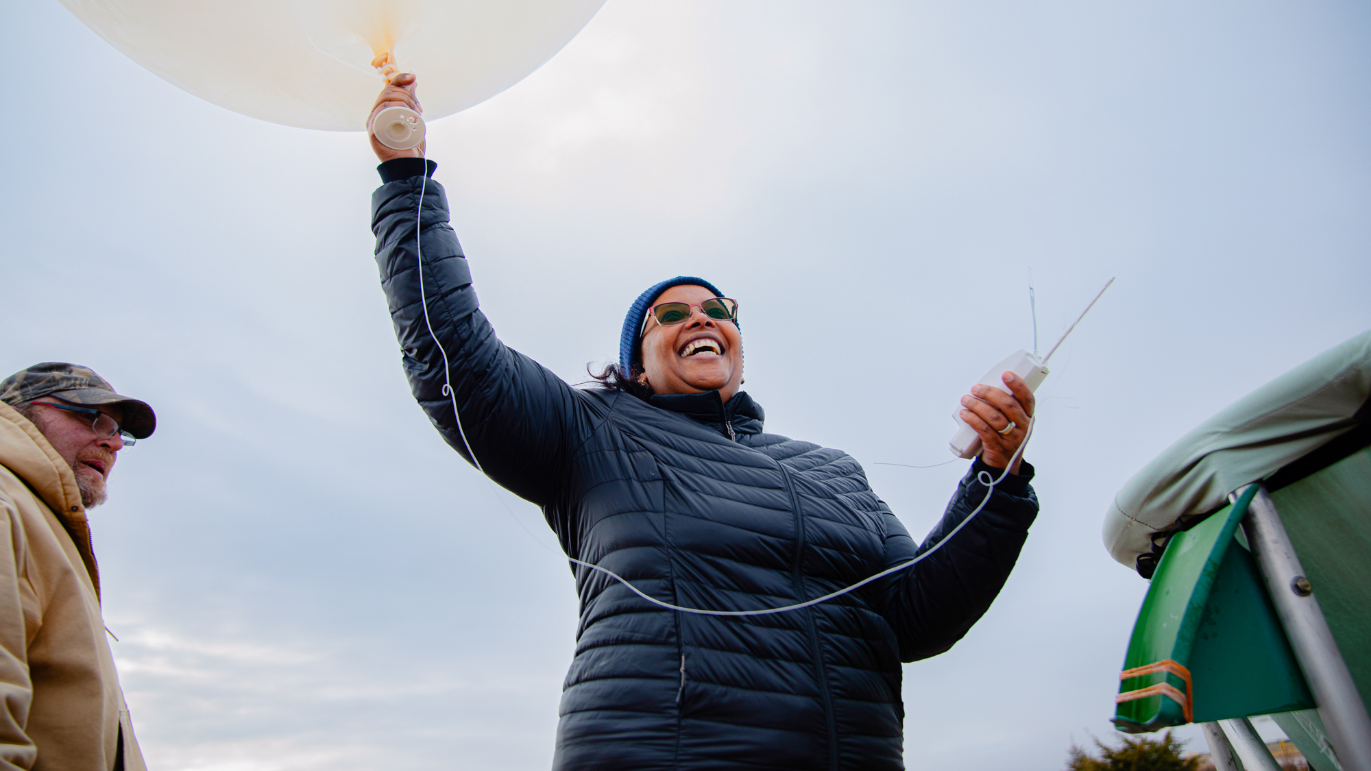
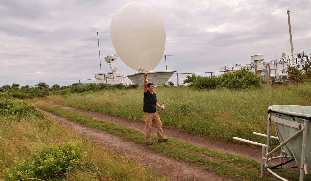
DOE Office of Science Director Asmeret Asefaw Berhe helps launch a weather balloon at the SGP Central Facility.
“Overall, this was a great opportunity to showcase the effort it takes to operate ARM’s largest and longest-serving atmospheric observatory and the dedication of the staff to ARM’s mission,” said Argonne’s Adam Theisen, ARM’s instrument operations manager. “This was a truly unique experience, and we were happy to have DOE and laboratory management involved to tour this one-of-a-kind facility.”
After learning about ARM, the visitors were given a muddy walking tour of the SGP. They learned about the challenges of operating the site in a remote location and saw firsthand the difficulties staff have in getting to work on rural dirt and gravel roads. On the tour, they discussed instrumentation and how the larger ARM user facility operates. The group was able to get up close with instruments such as the two-dimensional (2D) video disdrometer, which measures the size and shape of raindrops. Berhe was even able to launch a weather balloon that measures profiles of temperature, humidity, and wind.
“ARM is a lot more than just operating instrumentation for a temporary period of time,” said Argonne’s Nicki Hickmon, ARM’s associate director for operations. “Through our complex user facility, we bring together ARM and scientist observations from significant climate regimes to any interested person free of charge. Currently, we host over four petabytes of data available to users.”
The visitors wanted to learn more about how ARM partners and collaborates with universities and colleges. The service-oriented nature of DOE user facilities lends natural support to outreach opportunities by making data freely available, explained Hickmon. ARM brings together instrument experts, data scientists, data analysts, and scientists from diverse disciplines, such as agriculture, aerospace engineering, soil and atmospheric chemistry, and many more.
“Our cutting-edge work at SGP and ARM will provide the needed data for better weather models,” said Sean L. Jones, Argonne deputy laboratory director for science and technology. “Visiting SGP was a remarkable experience, providing an insightful glimpse into the pivotal role it plays in advancing climate research.”
The ARM user facility is funded by BER.
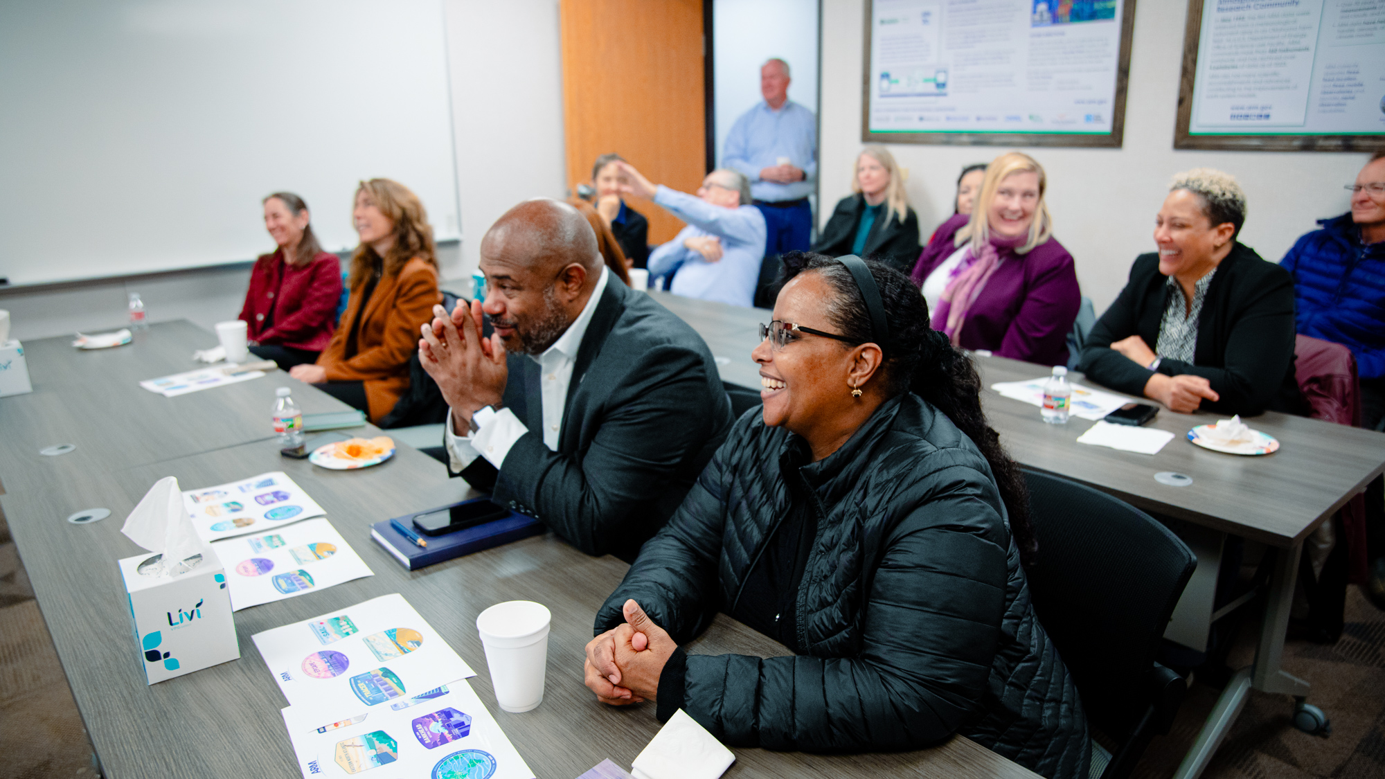
Visitors gather in a conference room for a crash course on ARM. In front of Berhe (foreground) are stickers showcasing ARM campaigns, observatories, and capabilities.
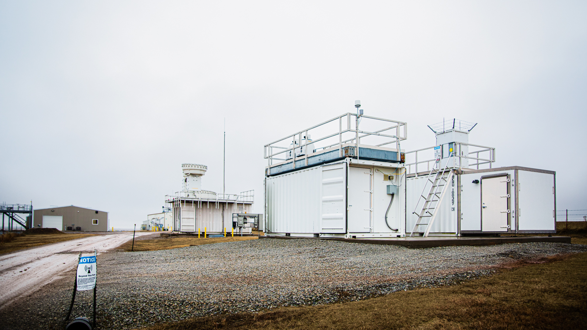
ARM deploys profiling instruments such as radars and lidars like those in the forefront to obtain information on cloud and aerosol properties above the site. The new Guest Instrument Facility (back left) provides a resource for scientists to deploy their own instruments.
Attendees get a high-level view of the SGP Central Facility from on top of the Radiometer Calibration Facility.
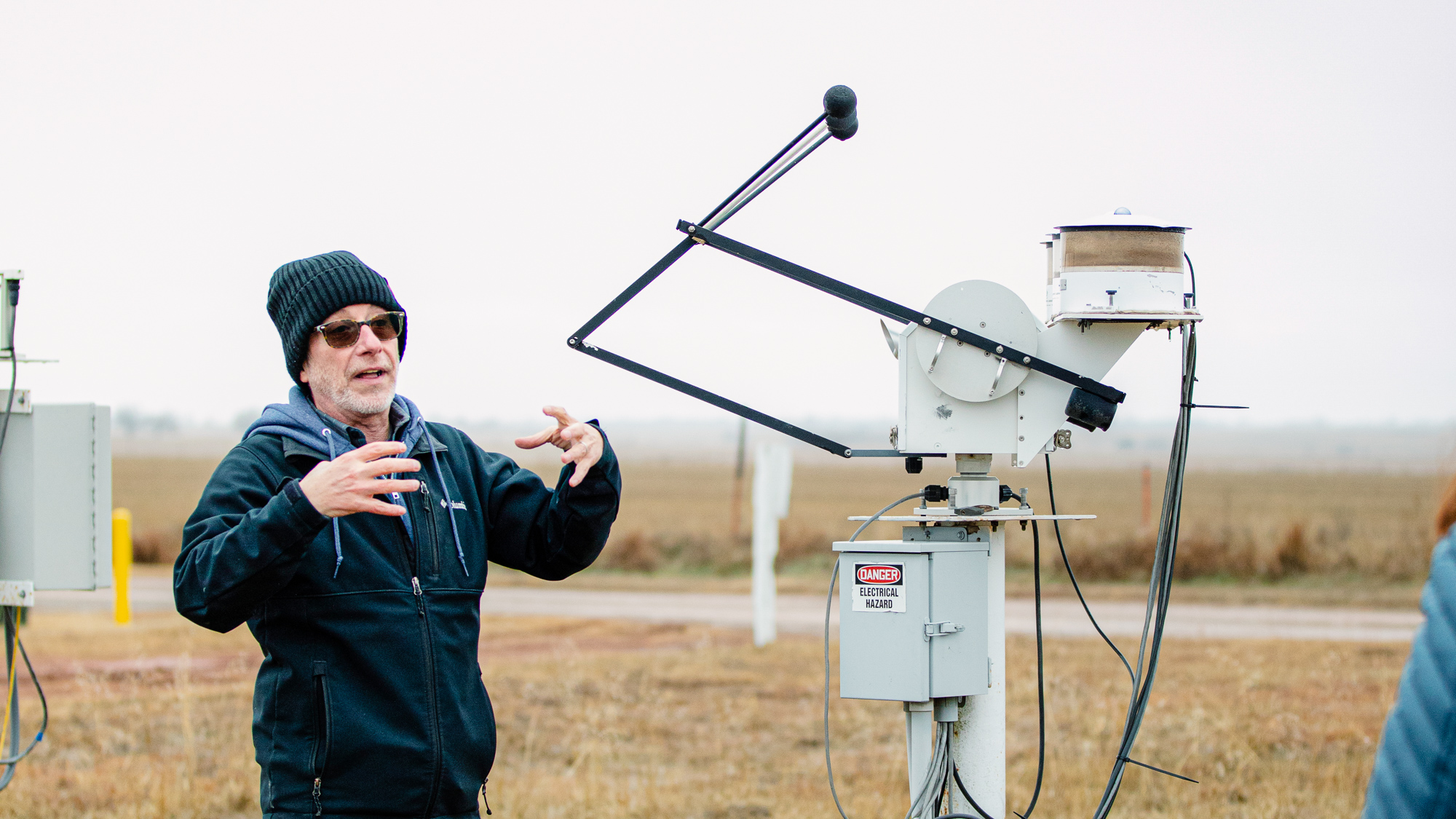
ARM SGP Manager Mike Ritsche describes how instrumentation in the field operates to collect valuable data for the scientific community. The solar infrared radiation station measures solar radiation.
With March being Women’s History Month, the Atmospheric Radiation Measurement (ARM) user facility wants to acknowledge the many women who have been important contributors to ARM’s success.
The list below is by no means comprehensive. Rather, this page features current ARM and Atmospheric System Research (ASR) program managers, infrastructure staff, User Executive Committee (UEC) members, constituent group chairs, principal investigators, and other scientists participating in field campaigns.
U.S. Department of Energy (DOE) ARM and ASR Leadership
Sally McFarlane
ARM Program Manager, 2014 to present
Sally McFarlane
Sally McFarlane co-managed ASR for a year and a half before moving to ARM in 2014. McFarlane also co-manages a topic in Atmospheric Measurement Technology for DOE’s Small Business Innovation Research program. As an active researcher, beginning in 1999, McFarlane racked up 50-plus peer-reviewed publications―many of them on the atmospheric radiative effect of clouds and aerosols. Her work included studies of dust storms in sub-Saharan Africa, ice and mixed-phase cloud properties (using NASA satellite data), and the utility of uncrewed aerial systems in arctic Alaska.
Shaima Nasiri
ASR Program Manager, 2014 to present
Shaima Nasiri
Atmospheric scientist Shaima Nasiri is one of two program managers for ASR, which resides in DOE’s Biological and Environmental Research program. Nasiri also belongs to the Interagency Council for Advancing Meteorological Services Committee on Research and Innovation, and she is a member of the U.S. Group on Earth Observations (USGEO), a federal interagency partnership on civilian Earth observation activity. She is a co-chair of USGEO’s Satellite Needs Working Group, which conducts a biennial collection of federal agency satellite Earth observation needs for NASA to consider as part of its satellite systems engineering and budgeting processes. Nasiri joined ASR from Texas A&M University, where she taught classes in introductory meteorology, cloud physics, radiative transfer, and remote sensing.
Jennifer Comstock
ARM Associate Director for Research
Pacific Northwest National Laboratory
Jennifer Comstock
After earning her PhD in meteorology at the University of Utah, Jennifer Comstock moved to Washington state to join Pacific Northwest National Laboratory in 2000. It was there she acquired a deep familiarity with many facets of ARM, including as a science translator, deputy director of the ARM Aerial Facility, and now as the scientist who coordinates development activities and sets priorities for ARM’s measurements and science products. In time, Comstock took part in at least a dozen ARM field campaigns, often as a resident expert on remote-sensing techniques. ARM data have informed most of her more than 50 peer-reviewed papers, which show Comstock to be a student of all things cloud, including their processes, life cycles, convective properties, optical depths, aerosol burdens, and radiative effects.
Read Comstock’s latest development blog post here.
Nicki Hickmon
ARM Associate Director for Operations
Argonne National Laboratory
Nicki Hickmon
In 2004, with a master’s degree in meteorology in hand from the University of Oklahoma, Nicki Hickmon set out on a career that has included software development, project management, ARM Mobile Facility instrument maintenance, a stint as facility manager of ARM’s Southern Great Plains (SGP) atmospheric observatory, and extensive fieldwork. She has been part of ARM campaigns in mountainous Colorado, the Maldives, aboard a ship transecting the Pacific, and at a snow-cloaked field site in remote, boreal Finland. In addition to her ARM role, Hickmon is a member of the core team for DOE’s Artificial Intelligence for Earth System Predictability initiative. Its mission is to develop AI strategies to improve earth system predictability.
Jennifer Delamere
UEC Chair/Representative for Radiative Transfer
University of Alaska, Fairbanks
Jennifer Delamere
Jennifer Delamere studies the Arctic environment from ground and space. As research faculty at the University of Alaska Fairbanks, Delamere is part of a multiyear project recording how springtime snowmelt influences the reflectivity of snow and other surface features. Delamere is also the director of the Geographic Information Network of Alaska, where she manages a downlink facility for polar-orbiting satellites. In 2023, Delamere became the UEC chair.
Sarah Brooks
UEC Representative for Aerial Measurements
Texas A&M University
Sarah Brooks
As a supplier and user of ARM data, Sarah Brooks sought a position on the UEC because she wanted to ensure a quality connection between the people working hard to generate the data and those using them. Brooks, a research scientist, professor, and director of the Center for Atmospheric Chemistry and the Environment at Texas A&M University, collected data with her continuous flow diffusion chamber as part of 2008’s Indirect and Semi-Direct Aerosol Campaign (ISDAC) at ARM’s North Slope of Alaska atmospheric observatory. The instrument counts ice-nucleating particles (INPs) and includes a depolarization detector that differentiates between droplets and ice. More recently, Brooks led an INP campaign related to ARM’s 2021–2022 TRacking Aerosol Convection interactions ExpeRiment (TRACER) in the Houston, Texas, area. The TRACER-INP campaign focused on quantifying aerosol concentrations around Houston and their ability to act as INPs.
Susannah Burrows
UEC Representative for Aerosol Modeling
Pacific Northwest National Laboratory
Susannah Burrows
In second grade, a teacher asked Susannah Burrows to keep a daily journal of the weather. From there, curiosity took over. Today, Burrows leads a team of scientists studying the tiny atmospheric particles that initiate ice formation in clouds. The team is using particle samples from the SGP and Southern Ocean. Within the UEC, Burrows chairs a subgroup to enhance communication with scientists working with models such as DOE’s Energy Exascale Earth System Model (E3SM).
Jessie Creamean
UEC Representative for Aerosol Measurements
Colorado State University
Jessie Creamean
Jessie Creamean, an Illinois native with a taste for research in the world’s coldest places, is a specialist in aerosols. She is an ARM aerosol mentor and a widely published university author who hopes to attract more users to ARM data. Creamean mainly investigates INPs, the bits of matter—dust, pollen, sea spray, and more—that seed ice in clouds. They affect the reflectivity of clouds and help make precipitation possible. In September 2019, Creamean was among the first scientists to head for the central Arctic on a research icebreaker as part of the Multidisciplinary Drifting Observatory for the Study of Arctic Climate (MOSAiC) expedition. In addition to her role as the UEC representative for aerosol measurements, Creamean is co-chair of the ASR high-latitude processes working group and is the lead instrument mentor for ARM’s ice nucleation spectrometer.
Erika Roesler
UEC Representative for Cloud Modeling, High-Resolution Modeling
Sandia National Laboratories
Erika Roesler
Erika Roesler, an atmospheric scientist at Sandia National Laboratories, explores the relationship between ARM and the climate modeling community in her role as part of a UEC subgroup that hopes to enhance communication efforts between ARM and modelers. Roesler is looking at how researchers could better apply DOE’s E3SM and other global modeling data to understand potentially extreme future climate conditions. A recent project of Roesler’s, a special configuration of E3SM, uses a grid-like regionally refined “mesh model” over the Arctic. It’s part of DOE’s High-Latitude Application and Testing of Earth System Models Science Focus Area.
Maria Zawadowicz
UEC Representative for Aerosol Measurements, Land-Atmosphere Interactions
Brookhaven National Laboratory
Maria Zawadowicz
Tiny particles make a big impact for Maria Zawadowicz. The Brookhaven National Laboratory assistant environmental scientist designs aerosol field instruments and serves as the lead instrument mentor for ARM’s aerosol chemical speciation monitor. Currently, Zawadowicz is a co-investigator in a project sponsored by ASR: the Process-level AdvancementS of Climate through Cloud and Aerosol Lifecycle Studies (PASCCALS) Science Focus Area. PASCCALS is investigating the multifaceted magnitude of how aerosols and clouds influence the Earth’s energy budget. Zawadowicz’s PASCCALS research centers primarily on analyzing aerosol data that was collected during ARM’s TRACER field campaign. In 2023, Zawadowicz was named vice chair of the instrumentation working group within the American Association for Aerosol Research (AAAR). She also chairs the UEC’s Measurement Uncertainty and Communicating Calibrations subgroup.
Yunyan Zhang UEC Representative for Land-Atmosphere Interactions
Lawrence Livermore National Laboratory
Yunyan Zhang
Yunyan Zhang models the life cycles of clouds and the complex interactions of land and atmosphere. Her work attempts to overcome the uncertainties in numerical simulations of the Earth’s atmospheric boundary layer. That’s the lowest band of the atmosphere, where weather happens. It is also where clouds are influenced by surface conditions, including heat fluxes, wind, and complex vegetation. Zhang also studies the atmospheric diurnal cycle, which causes variations in daytime and nighttime temperatures near the Earth’s surface. Modeling the links between land and atmosphere is critical for predicting regional weather as well as the climatic state of earth systems.
Christine Chiu
Cloud and Precipitation Measurements and Science Group Chair
Colorado State University
Christine Chiu
Christine Chiu, a professor at Colorado State University, is always fascinated by how clouds evolve and influence Earth’s energy flow. Chiu combines remote sensing observations from ARM scanning cloud radars and other instruments to boost our understanding of cloud physical processes, aiming to improve how current models represent clouds. Her research interest in radiative transfer and the interlocking relationships of clouds, aerosol, and precipitation also led her to explore artificial intelligence, which is “a perfect marriage,” she says, with voluminous ARM data. Her work as an ARM constituent group chair brings together scientists representing the ARM research community and experts in engineering, instrument operations, and data translation to address critical gaps of science and data in cloud and precipitation research.
Gannet Hallar
Aerosol Measurement Science Group Co-Chair
University of Utah/Storm Peak Laboratory
Gannet Haller
Gannet Hallar is a professor of atmospheric science at the University of Utah and is the director at Storm Peak Laboratory, a high-altitude research center in Colorado run by the University of Utah. From the fall of 2010 to the spring of 2011, Hallar participated in ARM’s Storm Peak Lab Cloud Property Validation Experiment (STORMVEX), a field campaign designed to collect data on wintertime cloud and aerosol properties, from within the clouds themselves. In May 2024, she will be the first principal investigator of a field campaign using ARM’s ArcticShark uncrewed aerial system.
Rebecca Adams-Selin
Verisk Atmospheric and Environmental Research
Rebecca Adams-Selin
Rebecca Adams-Selin is an atmospheric scientist and a senior manager of science in the Modeling Atmospheric Components and Processes Section at Verisk Atmospheric and Environmental Research. In 2022, Adams-Selin and three fellow researchers launched an ambitious effort to investigate and model some little-understood features of mesoscale (regional-scale) convective systems. Their three-year project, “Establishing a Holistic Understanding of the Circulations of Mesoscale Convective System Stratiform Regions,” is funded by ASR and will use data collected during ARM’s 2011 Midlatitude Continental Convective Clouds Experiment (MC3E) and the 2015 multi-agency Plains Elevated Convection at Night (PECAN) Experiment. Both campaigns took place at the SGP.
Allison C. Aiken
Former UEC Chair
Los Alamos National Laboratory
Allison Aiken
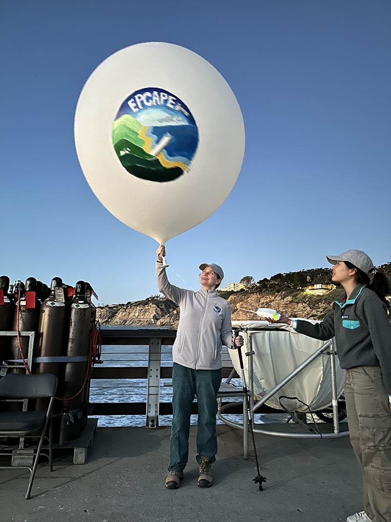
Allison C. Aiken is a highly cited author of more than 50 papers, most of them on the properties, evolution, and transport of aerosols. These ultrafine liquid and solid particles influence cloud formation, precipitation, and the amount of solar radiation reaching the Earth’s surface. Among the aerosols Aiken studies are those from wildfires, which can scatter for thousands of miles or linger to influence regional weather and air-quality conditions as well as supermicron and bioaerosols. Most recently, Aiken served as a co-investigator for the Surface Atmosphere Integrated Field Laboratory (SAIL) field campaign in Colorado and the Eastern Pacific Cloud Aerosol Precipitation Experiment (EPCAPE) in Southern California.
Ogochukwu Enekwizu is an assistant environmental scientist in the Environmental and Climate Sciences Department at DOE’s Brookhaven National Laboratory. Her research is focused mainly on soot—specifically the black carbon particles emitted by wildfires. Data from the laboratory experiments and real-world studies, including data collected during ARM’s Biomass Burning Observation Project (BBOP) and Layered Atlantic Smoke Interactions with Clouds (LASIC) field campaigns, have been used by Enekwizu and her Brookhaven colleagues in their study of how smoke aerosols influence cloud formation and lifetime. Enekwizu, along with fellow Brookhaven researcher Maria Zawadowicz, is a co-investigator on the ASR-supported PASCCALS Science Focus Area and is an associate instrument mentor for ARM’s cloud condensation nuclei particle counter, single particle soot photometer, and aethalometer. She is the current vice chair of the AAAR combustion and materials synthesis working group.
Lynn Russell
Scripps Institution of Oceanography at the University of California San Diego
Lynn Russell
A professor at Scripps, Lynn Russell led the EPCAPE campaign in La Jolla, California, from February 2023 to February 2024. EPCAPE deployed instruments at the urbanized coastal edge of the eastern Pacific to record how aerosols from polluted and pristine sources affect low marine stratocumulus clouds. The data collected capture cloud spatial extent, radiative properties, precipitation, and aerosol interactions and concentrations. From 2015 to 2017, Russell co-led the ARM West Antarctic Radiation Experiment (AWARE), considered the most comprehensive meteorological field campaign in West Antarctica since 1957.
Allison Steiner, a professor and research team lead at the University of Michigan, studies biological aerosols that start as pollen. A recent ASR-funded project led by Steiner focused on SGP field observations that provided evidence of pollen in the planetary boundary layer and pollen components in cloud droplets and fine particulate matter. More recently, Steiner has shifted her focus to an ARM atmospheric observatory in northwestern Alabama. As a member of the site science team for the deployment of the third ARM Mobile Facility (AMF3), Steiner has helped guide the move of AMF3 from Oliktok Point, Alaska, to Alabama’s Bankhead National Forest to help maximize the scientific value and impact of the new location.
The coastal marine cloud-aerosol campaign now enters a phase of energetic data analysis
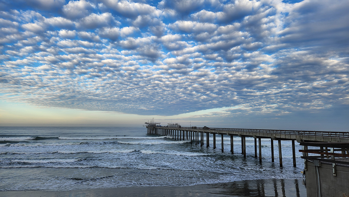
Lynn Russell, principal investigator of the yearlong Eastern Pacific Cloud Aerosol Precipitation Experiment (EPCAPE), launches the field campaign’s final radiosonde at 6 p.m. Pacific on February 14, 2024. The launch took place on the Ellen Browning Scripps Memorial Pier in La Jolla, California. Photo is by Juarez Viegas, Los Alamos National Laboratory.
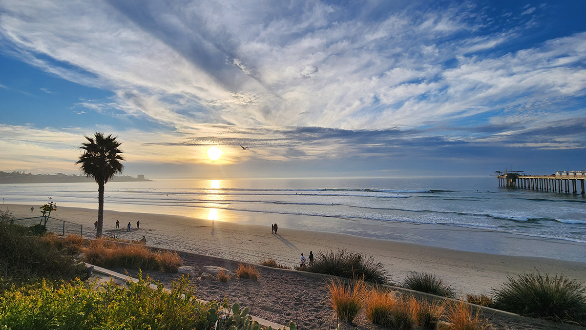
Off the coast of La Jolla, California, not far from downtown San Diego, marine stratocumulus clouds often appear in dramatic decks.
The surfers who crowd along either side of the Ellen Browning Scripps Memorial Pier might take for granted these gatherings of liquid water, ice (occasionally), particles, and complex gases.
But to a cohort of international scientists, these clouds are of intense interest.
The prospects are exciting for EPCAPE Principal Investigator Lynn Russell, a Distinguished Professor of Climate and Atmospheric Sciences at Scripps Institution of Oceanography at the University of California San Diego.
EPCAPE “was amazingly successful,” she says. “We got more clouds, more data, and more investigators than we expected.”
‘Detailed and Extensive’
Enthusiasm for EPCAPE data is shared by the campaign’s 17 co-investigators, who represent a dozen universities in the United States and Canada, three U.S. Department of Energy (DOE) national laboratories, NASA, and Environment and Climate Change Canada.
DOE’s Atmospheric Radiation Measurement (ARM) user facility supplied the main instrumentation for EPCAPE, supplemented by the campaign’s many partners.
ARM deployed one of its three portable atmospheric observatories, known as the first ARM Mobile Facility (AMF1), along Scripps Pier. A smaller set of ARM and guest instruments operated on Mount Soledad, 3 kilometers (1.9 miles) from the pier.
“To my knowledge, EPCAPE has produced the most detailed and extensive probing of California coastal marine stratus to date,” says EPCAPE co-investigator Mark Miller, a professor of atmospheric science at Rutgers University. “Especially unique is the comprehensive aerosol and cloud microphysical assays collected on Mount Soledad, which deeply enrich the data collected by AMF1.”
In this January 2024 photo, Scripps Pier, arrayed with ARM containers and instruments, juts out into the Pacific Ocean. Photo is by Ana Gabriela “Gabi” Pessoa, Hamelmann Communications.
Four-Season Data
On Mount Soledad in La Jolla, ARM radars and a variety of guest instruments collected data during EPCAPE, sometimes from within hovering banks of marine clouds. Photo is by Gregory Roberts, Scripps Institution of Oceanography.
Marine stratocumulus clouds, the object of EPCAPE’s year of observational attention, reside in the lower mile or so of the troposphere―what scientists call the atmosphere’s boundary layer.
They also predominate over oceans in the Earth’s middle latitudes―the regions between 30 and 60 degrees north and south of the equator.
Marine stratocumulus clouds, easily perturbed by environmental changes, influence how much solar radiation reaches the Earth’s surface as well as patterns and amounts of precipitation.
EPCAPE was designed to provide unprecedented four-season data on the properties of coastal marine clouds, including their radiative effects and the role human-made particles play.
The yearlong data add great value, says aerosol chemist Allison Aiken, an EPCAPE co-investigator from Los Alamos National Laboratory (LANL) in New Mexico. “The data set reflects periods of clean marine origin, urban emissions that have aged (evolved) over the ocean, and periods when clouds moved inland from the main site at the pier to the supplementary site on Mount Soledad.”
‘Rare and Unique Globally’
This picture captures the flurry of activity during the EPCAPE instrument pack-up in mid-February 2024. Photo is by Viegas.
You can think of EPCAPE’s year of observations as a two-layer cake. The bottom layer captured ocean-like influences at the surface, largely by ARM instruments strung along the pier. The second layer, on Mount Soledad, collected data on marine clouds higher up.
Despite its modest altitude (250 meters, or 820 feet), Mount Soledad sometimes sat within the cloud layer itself, yielding in-cloud measurements, including particle and aerosol composition.
Atmospheric aerosols are tiny particulate hybrids of solids and liquids, including water. They make clouds and precipitation possible.
Researchers will be able to examine aerosols with very similar histories measured during EPCAPE both in cloud and out of cloud, says Russell. “That’s one of the most exciting outcomes.”
Aiken couldn’t agree more. She believes EPCAPE was the first time that guest instruments, using specialized inlets, could sample aerosols directly from inside clouds.
Such data, says Aiken, “are rare and unique globally, and we hope to help answer some of the outstanding questions (about cloud formation) in an area impacted by different marine and urban sources.”
Cloud formation requires understanding turbulence, water vapor evaporation and condensation, the presence of condensation nuclei from dust and other particles, precipitation, cloud radiative absorption and scattering, and aerosol formation and evolution.
Calling on CC-RIDER
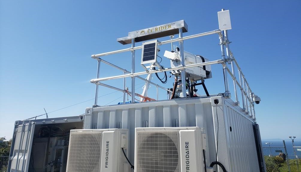
At the Mount Soledad site, EPCAPE co-investigator Dan Lubin installed Clouds and Climate-Remote Integrated DEployment of Radiometers (CC-RIDER). This suite of instruments, along with ARM radiometers on Scripps Pier, gave the campaign parallel radiometric measurements at two altitudes below most cloud bases. Photo is courtesy of Lubin, Scripps Institution of Oceanography.
Russell and Scripps colleagues have started working with modelers to analyze EPCAPE’s turbulence, cloud, and aerosol measurements.
Turbulence in the atmospheric boundary layer, marked by chaotic swirls and eddies of air and particles, can accelerate heat transfer and modify cloud formation.
EPCAPE co-investigator Dan Lubin, a climate sciences researcher at Scripps, plans to analyze his own data for different turbulent conditions. His analysis will include how turbulence affects cloud liquid water content, he says, along with “optical depth and brightening, and ultimately surface shortwave and longwave radiation.”
On Mount Soledad, he installed a suite of broadband and filter radiometers called Clouds and Climate-Remote Integrated DEployment of Radiometers (CC-RIDER). The instruments, paired with data from ARM’s roughly equivalent sky radiometers on stand for downwelling radiation (SKYRAD) on the pier, will provide radiometric measurements at two altitudes.
“Preliminary data are very interesting,” says Lubin, who has done some early analysis.
But a full analysis, he adds, can only happen after post-campaign calibration of the CC-RIDER radiometers by the manufacturer.
The Old, the New, and the Small
The restless ocean and atmosphere around Scripps Pier is on full display in this January 2024 view. Photo is by Pessoa.
Miller is eager to get at EPCAPE data too, perhaps as early as June 2024.
Mount Soledad was in cloud for about 700 hours during the campaign, which is “surprising,” he says. “Early indications suggest that at least some of these clouds have not been overwhelmingly influenced by the terrain and may be similar in structure to the clouds measured at the Scripps Pier.”
MASRAD, which later influenced EPCAPE’s science plan, allowed researchers to study the microphysical characteristics of marine stratus clouds as they moved onshore.
LANL researchers are analyzing the data now, she says, in part to understand cloud processing better by looking for “chemical differences in the aerosol” during in-cloud and out-of-cloud periods.
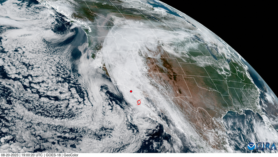
A GOES-18 RGB (Red-Green-Blue) composite satellite image of Tropical Storm Hilary on August 20, 2023, shows the cyclone’s center a few hundred kilometers south of the EPCAPE deployment, noted by a red marker.
Heavy doses of extreme weather enriched EPCAPE data.
Atmospheric rivers—ribbon-like currents of ocean moisture—contributed to record California rainfall, including an epic rainstorm in March 2023. In August, Tropical Storm Hilary was the first such storm to hit Southern California in 84 years.
“Those events looked rather different than what we were generally expecting in the science plan,” says EPCAPE co-investigator and ARM data analyst Israel Silber.
Silber, an earth scientist at Pacific Northwest National Laboratory in Washington state, wrote a September 2023 ARM blog about the instrumented glimpse of Hilary by EPCAPE radars, lidars, and other observation platforms.
“It was more of an exciting coincidence than a finding, per se,” he says. “But additional analysis of this event might provide new insights.”
An ARM total sky imager on Scripps Pier captured daylight images that provide a video-like timeline of Hilary’s prefrontal clouds and precipitating storm cells.
“We had a pretty exciting year in terms of meteorology,” says Russell, “much more rainfall than we’ve probably had in decades—more precipitation than we expected.”
Heavy rain might factor into aerosol-cloud events in some intriguing ways, she adds, because it is good at “cleaning up the air” by stripping aerosols from the atmosphere, even those still in the gas phase.
This means processes are wiped clean and can start over, says Russell. “Heavy rain provides a reset of particle and some vapor concentrations. That’s going to be super interesting to look into.”
With a data boost from ARM during planning, a new project off the New England coast is making observations to inform predictive models of offshore wind energy resources
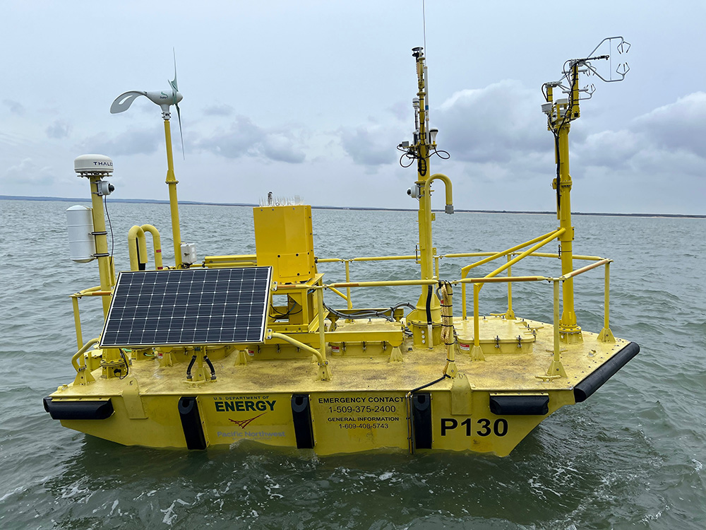
A U.S. Department of Energy lidar buoy, managed by Pacific Northwest National Laboratory, gathers data on wind speed and other atmospheric phenomena during the Wind Forecast Improvement Project-3 (WFIP-3) off the coast of New England. To the right is a flux sensor, installed in cooperation with the University at Albany in New York. Photo is by Matt Brooking, University at Albany.
Offshore wind turbines can be up to 300 meters (984 feet) tall—nearly twice the height of the Washington Monument.
“As winds are higher offshore than on land, tall wind turbines are currently being installed to maximize investments,” says Raghavendra Krishnamurthy, a remote sensing expert at Pacific Northwest National Laboratory (PNNL) in Washington state.
Maximizing the efficiency of these giant structures, however, is a very tall order—one that requires improved forecasting models of offshore conditions.
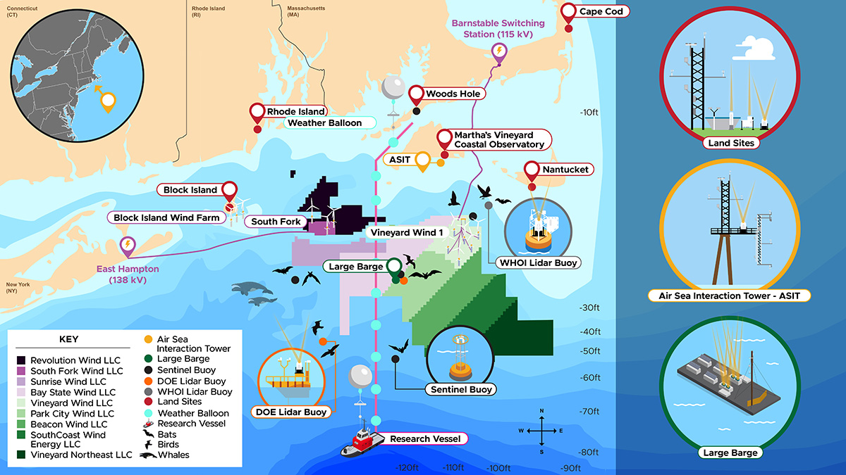
Improved models require more and better observations. This is why PNNL is leading the Wind Forecast Improvement Project-3 (WFIP-3), an 18-month offshore wind observation field campaign now underway in a patch of the Atlantic Ocean near the Massachusetts islands of Nantucket and Martha’s Vineyard.
WFIP-3 is a multi-institutional effort funded by the Wind Energy Technologies Office within the U.S. Department of Energy (DOE) and NOAA. The study’s design was informed by data collected during the Two-Column Aerosol Project (TCAP), a 12-month field campaign based at Cape Cod, Massachusetts, in 2012 and 2013.
The TCAP campaign was conducted by DOE’s Atmospheric Radiation Measurement (ARM) user facility and led by PNNL’s Larry Berg. It deployed ground-based and aircraft instrumentation to study aerosols, clouds, and their interactions.
Remote sensing and radiosonde data from TCAP are being used to assess the uncertainties of predicting offshore winds, says Sheng-Lun Tai, a modeler at PNNL, referring to the area of the Atlantic off New England. “The TCAP data have been extremely helpful in understanding the complexities of various wind regimes in the region and to assess the accuracy of current-generation atmospheric models.”
TCAP Sets the Stage
During ARM’s 2012–2013 Two-Column Aerosol Project (TCAP), radiosondes attached to weather balloons helped measure coastal wind patterns. Radiosonde launches took place four times a day from Cape Cod, Massachusetts. Here, a local “education ranger” demonstrates a hand launch for area teachers and students.
The primary mission of the TCAP campaign was to measure details of atmospheric particles and their influences on cloud droplet formation. This critical stage in cloud development happens when water vapor—a gas—transitions to liquid water or ice crystals, making clouds visible.
TCAP measured two main sets of influences on cloud droplet formation: the properties of clouds themselves and the size, morphology, and chemical composition of cloud-forming aerosols.
The campaign did not set out to explicitly measure wind properties, which go unmentioned in the 2011 TCAP Science Plan. But nevertheless, TCAP’s standard meteorological sensors and instruments gave WFIP-3 planners a baseline of useful wind data. TCAP’s Doppler lidar, for instance, provided data on horizontal wind profiles, wind statistics, and vertical winds.
ARM’s Gulfstream-159 (G-1) research aircraft takes off for a TCAP flight from Cape Cod Gateway Airport in Hyannis, Massachusetts, in February 2013.
As Krishnamurthy’s PNNL team worked on how TCAP data could help guide WFIP-3, they also used some of the campaign’s aircraft measurements to guide model results and make quantitative comparisons easier.
Off the coast of Cape Cod, during intensive operational periods in the summer and winter, ARM’s now-retired Gulfstream-159 (G-1) research aircraft sampled atmospheric conditions in the lower troposphere—that is, below about 4,000 meters (13,120 feet).
Some of the G-1 data captured conditions very close to the surface, from 100 to 500 meters (328 to 1,640 feet) above sea level. Measurements at such low altitudes are especially relevant to predicting offshore wind energy resources.
To make wind-related data more accessible, TCAP data inspired two ARM value-added products. One was Gridded Sonde (SONDEGRID), derived in part from measurements of horizontal winds. Another was Planetary Boundary Layer Height (PBLHT). That’s important because the depth of the marine atmospheric boundary layer is a critical dimension for improving the accuracy of marine wind forecasts.
TCAP illustrates the durable utility of older ARM data. Selected campaign measurements helped reduce some of the uncertainty in the current generation of models, says Krishnamurthy. “We were able to understand where to focus our work on developing new parameterizations.”
In modeling weather and climate, parameterizations simplify processes that are too small or too complex to be represented physically.
Krishnamurthy’s PNNL team has a paper in the works detailing TCAP’s usefulness to WFIP-3. Meanwhile, TCAP data remain freely available in the ARM Data Center.
WFIP-3 field study assets are deployed near the Northeastern U.S. outer continental shelf, including wind-energy lease areas under development. Image is by Stephanie King, Pacific Northwest National Laboratory.
A WFIP-3 Team
Within its science mission, WFIP-3 set out to broaden and update the kind of data TCAP provided on the way to improving numerical models of wind energy forecasts.
WFIP-3 is the third in a series of collaborative DOE/NOAA wind observation projects. The others took place in the northern and southern Great Plains and the Columbia River Gorge and Columbia Basin in eastern Washington and Oregon.
Within its science mission, WFIP-3 set out to broaden and update the kind of data TCAP provided on the way to improving numerical models of wind energy forecasts.
The campaign is being primarily conducted by PNNL, Argonne National Laboratory in Illinois, multiple NOAA laboratories, and Woods Hole Oceanographic Institution in Massachusetts. About 60 scientists are involved from these and other institutions, many of them with funding from DOE’s Wind Energy Technologies Office.
WFIP-3’s designers expect that its 18 months of offshore data will improve predictive models of weather, wind, and wave conditions influencing the near-shore, fixed-bottom turbines in the Atlantic.
Fixed-bottom technology is used in water depths of 60 meters (197 feet) or less. Offshore wind turbines that float farther out in the ocean in deeper water are not part of the WFIP-3 mission.
Virendra Ghate, part of the WFIP-3 data analysis team at Argonne, calls the offshore field study “longer in duration, better instrumented, and better sited” than others of its kind along the northeastern Atlantic coast.
“It will collect data for longer than the annual cycle of winds, meteorology, clouds, and rain in the region,” says Ghate.
‘Highly Desired’ Observations
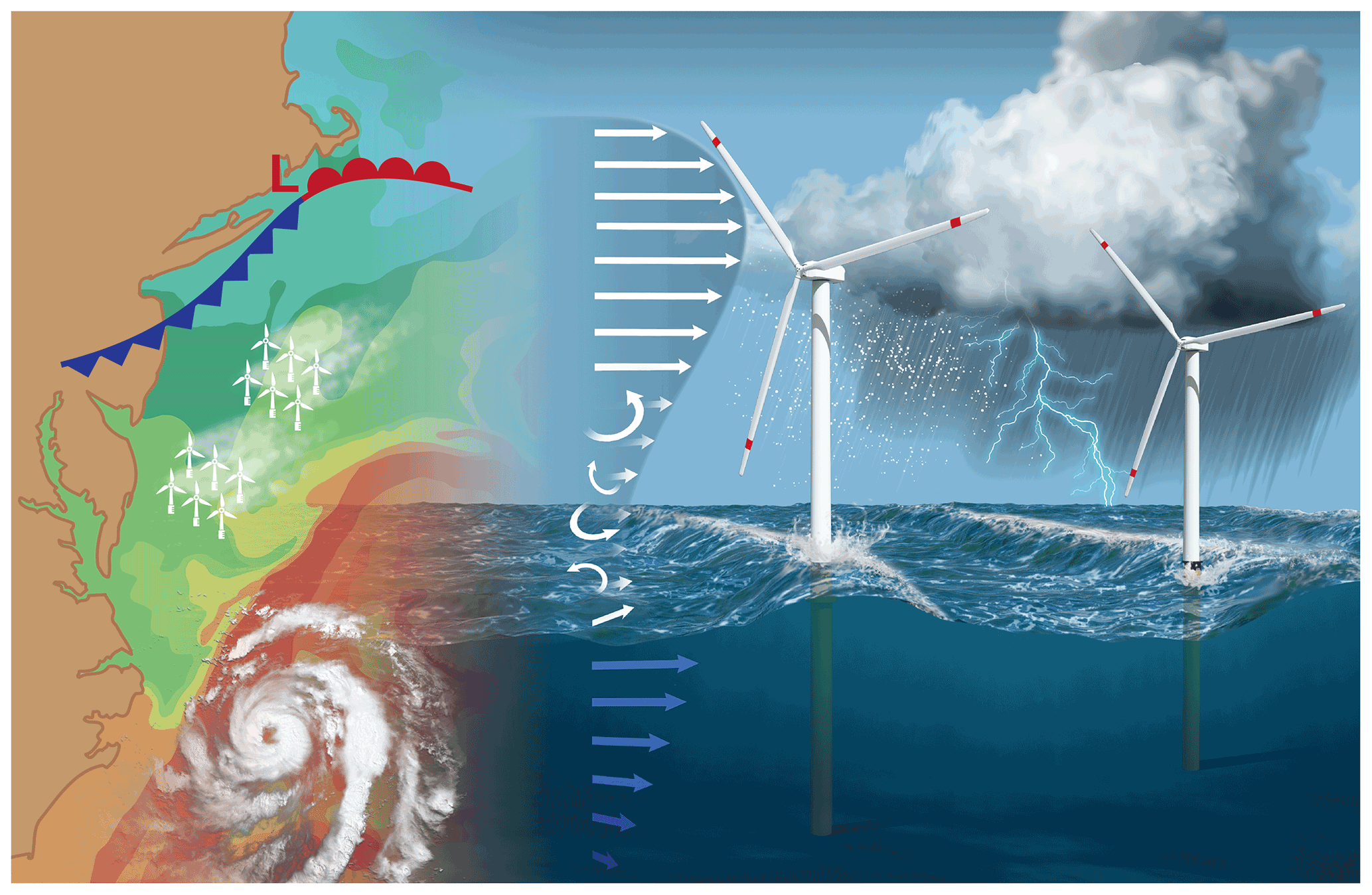
Offshore wind plants along the U.S. East Coast face weather and other challenges across a variety of spatial scales, from enormous tropical hurricanes and nor’easters to local-scale disturbances. These smaller disturbances can include low-level jets, breaking waves, small turbulent eddies, and wakes of air from multiple plants. Illustration is courtesy of the journal Wind Energy Science.
It is very demanding to create mathematical simulations of the metocean environment, which is influenced by the combined effects of meteorology and oceanography.
Modeling conditions around marine wind turbines is challenging because of the complex, fast-changing, and little-understood physics of a near-shore marine environment.
For one, wind speeds are altered by fast, unpredictable atmospheric jets that race near the ocean’s surface. Wind patterns are also influenced by rolling, heaving marine waves that vary in height and frequency.
Consider also that wind speeds driving offshore turbines change across very short time scales, from “minutes to hours,” as referenced in a 2016 paper co-authored by PNNL’s Berg.
In all, marine wind energy forecasts are clouded by uncertainties that make it difficult for wind energy companies to predict levels of available power.
But in energy terms, getting accurate forecasts of offshore wind energy resources is a high-stakes endeavor.
Capturing that potential requires better and more observations.
“The biggest hurdle (to improving models) is that we have very few long-term data sets that can be used to investigate these processes and interactions and how to represent them in model systems,” says Dave Turner, who directs the Atmospheric Science for Renewable Energy program at NOAA’s Global Systems Laboratory. “This is why we are so excited about the field campaign. WFIP-3 observations are highly desired by our model evaluation and development teams.”
The Right Tools
Instruments are deployed by the WFIP-3 team on the Massachusetts island of Nantucket. There are five other land-based instrument sites in Massachusetts and Rhode Island. Photo is by Raghavendra Krishnamurthy, Pacific Northwest National Laboratory.
Previous wind forecasting studies collected few offshore measurements. WFIP-3 will make up for that deficiency, says Paytsar Muradyan, who leads Argonne’s instrument deployment team.
instruments across six land-based observation sites in Massachusetts and Rhode Island
sentinel buoys to measure meteorology and ocean surface conditions
lidar buoys, two managed by PNNL and one by Woods Hole
a barge periodically deployed by Woods Hole, whose instruments include a W-band radar, a 20-meter (66-foot) flux tower, scanning Doppler lidars, and thermodynamic profilers
a Woods Hole research vessel for intensive operational periods
weather balloons launched from Woods Hole during intensive operational periods.
Muradyan called Woods Hole’s Air-Sea Interaction Tower, installed south of Martha’s Vineyard in 2002, “a very unique platform” in the WFIP-3 observations toolbox.
The tower is 22 meters (72 feet) above the ocean’s surface, “completely exposed to ocean wind and wave conditions,” she says.
Combined, adds Muradyan, the tower, barge, buoys, and land-based sites will create “a unique multiscale observational array.”
WFIP-3 instruments will characterize ocean and coastal land surfaces, surface meteorology, radiation, thermodynamic properties, and the prevalence of clouds and rain.
To Ghate, the Argonne data analyst, a key component of the campaign is the barge, “where measurements will be made in a truly offshore environment.”
Even more, he adds, WFIP-3 instruments are measuring atmospheric and oceanic properties over a wide spatial area in the northeastern Atlantic.
That distribution, says Ghate, provides a measure of data redundancy and, therefore, “more confidence in our analysis.”
Editor’s note: Heath Powers, site manager for the second ARM Mobile Facility (AMF2), sent in the following update about ARM’s site installation in Tasmania for the Cloud And Precipitation Experiment at kennaook (CAPE-k). Powers is based at Los Alamos National Laboratory in New Mexico.
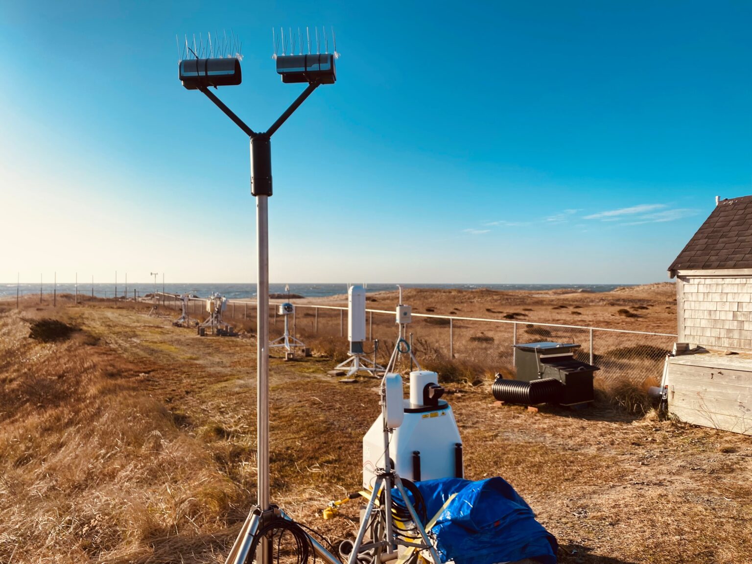
These instruments are set up to collect data for CAPE-k. Photo is courtesy of Tercio Silva, Fundação Gaspar Frutuoso.
On March 15, 2024, data verification started for CAPE-k. Now we have less than a month until ARM’s newest mobile facility deployment begins official operations April 15!
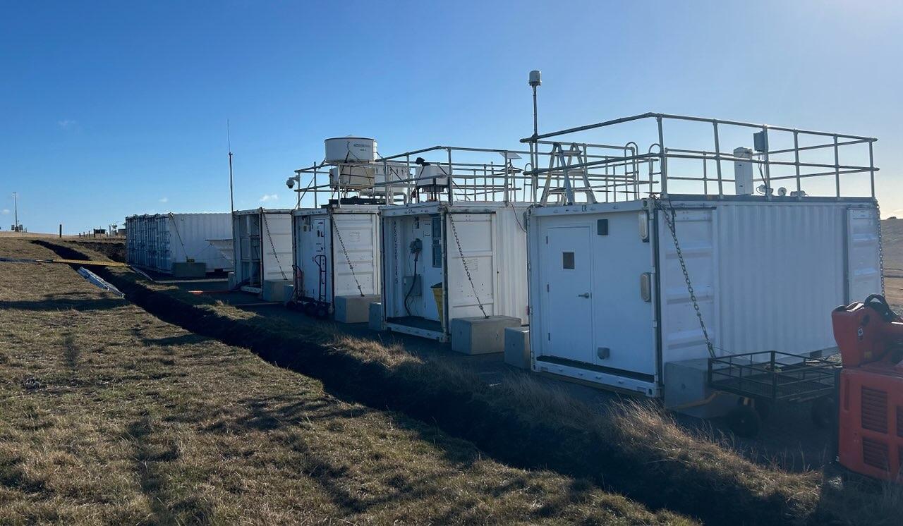
The CAPE-k installation began in earnest February 8 with the arrival of all the AMF2 observatory containers and equipment to the field site, which is located on the grounds of the Kennaook/Cape Grim (KCG) Baseline Air Pollution Station. Here is what was accomplished as of February 20, about two weeks into the installation period:
All main site shelters were in place, powered, and set up.
The guest Aerosol Observing System was installed beside the KCG station.
The automated weather balloon, or autosonde, launcher was set up and ready for a test launch.
All field instruments were “roughed in,” meaning they were set up, connected to power, and able to engage with their software.
The marine atmospheric emitted radiance interferometer (MAERI) was placed near the bluff to have a view of the ocean. ARM instrument mentor Jon Gero came onsite and configured the MAERI. The test data looked good.
Both micropulse lidars were set up, one as the ARM baseline configuration and the other as an instrument for intensive operational periods. Four of these periods are planned for CAPE-k.
Aerosol instrument locations were finalized. The KCG station was altering its inlet to give a better sample line for our aerodynamic particle sizer.
The data system was up and running. The network was mostly configured with good remote support from the site data systems team.
The Ka-Band ARM Zenith Radar and Marine W-Band ARM Cloud Radar collected test data. ARM radar mentor Andrei Lindenmaier was onsite to support the installation.
I returned to the United States in early March, knowing that things were going very well in Tasmania. The weather was mostly cooperative, with some sunny days interspersed with lots of wind and clouds. The KCG BOM (Bureau of Meteorology) and CSIRO (Commonwealth Scientific and Industrial Research Organisation) groups provided fantastic support for us all along the way.
The observatory is now fully installed and making pre-campaign measurements of the clouds and precipitation coming off the Southern Ocean from the remote northwestern tip of Tasmania. The crew there worked extremely efficiently and cheerfully on the installation. Technical and creative problem-solving was a constant, as was the diligent and hard work of this dedicated group of ARM professionals.
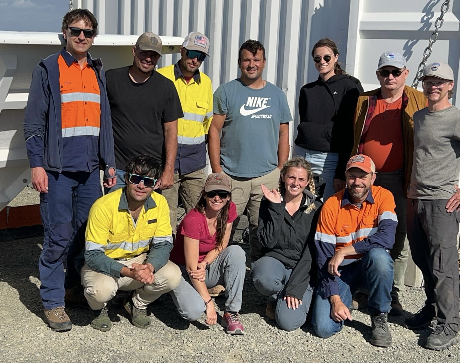
Here are some of the ARM team members working to make sure CAPE-k runs smoothly. In the back, from left to right, are Jon Gero, Michael Abraham, Tyler Campbell, Tercio Silva, Anna Bardin, Andrei Lindenmaier, and Frank Zurek. In the front, from left to right, are Tom Day, Julie Donohue, Savannah Byron, and Heath Powers. Photo is courtesy of Heath Powers, Los Alamos National Laboratory.
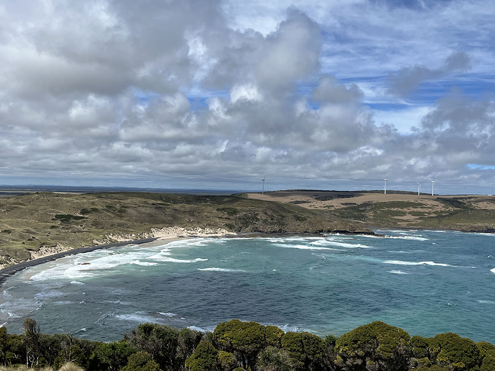
Mother Nature provides a picturesque preview of what CAPE-k scientists hope to observe from April 2024 to September 2025—lots of clouds. Photo is courtesy of Julie Donohue, Hamelmann Communications.
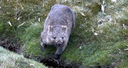
This wombat is ready for its close-up. Photo is courtesy of Heath Powers.
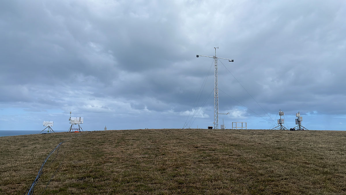
The landscape fills in with ARM instruments. Photo is courtesy of Frank Zurek, Hamelmann Communications.
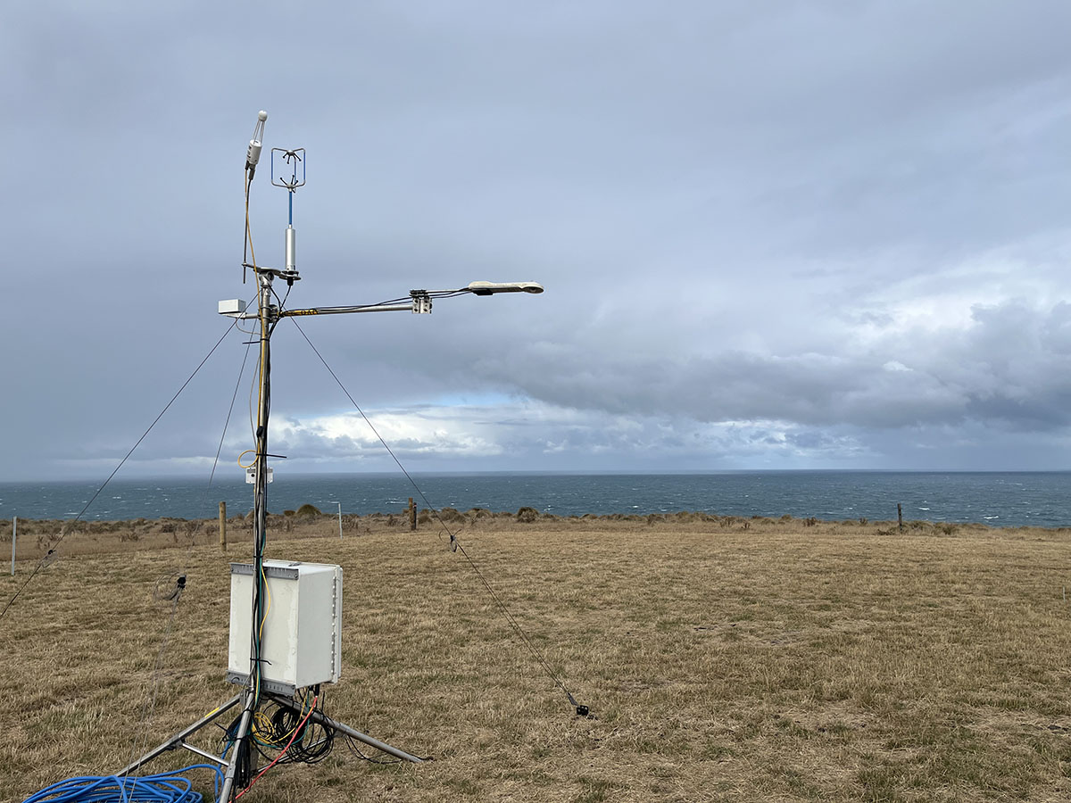
This eddy correlation flux measurement system has a sterling view of the ocean, land, and sky. Photo is courtesy of Frank Zurek.
The guest Aerosol Observing System is installed next to the Kennaook/Cape Grim Baseline Air Pollution Station. Photo is courtesy of Tercio Silva.
Check out summary report of October 2023 UEC meeting
During the User Executive Committee’s October 2023 meeting, those of us who attended in person got to tour ARM’s Southern Great Plains Central Facility. I am standing to the right, talking with Mike Ritsche, Jim Mather, Connor Flynn, and Yunyan Zhang. Photo is by Adam Theisen, Argonne National Laboratory.
Every time I write a blog for you, the ARM community, I try to craft a witty start to a 500-word discourse. I knew my topic for this blog was the announcement of our new report, “Summary of October 2023 ARM User Executive Committee Meeting.” This time, however, I couldn’t find wit, only a sense that it shouldn’t have taken me six months to draft this report. The best-laid plans of mice and men. … Well, heck, where did that phrase I’ve said many times come from? The actual phrase is “The best laid schemes o’ Mice an’ Men / Gang aft agley,” from a gem of a 1785 poem by Robert Burns, “To a Mouse.” Not understanding the Scottish dialect, I found a translation using Google: “The best-laid plans of mice and men often go awry.” Not witty, but at least you have a tidbit to take away!
COVID left many of us stranded in a virtual world in 2020 and 2021, the return from COVID in 2022 left us unsure, and now we all have our best-laid plans in between Zoom meetings, emails, and Slack messages. In contrast to our collective, frenetic pace, I found the UEC trip to the ARM Southern Great Plains (SGP) atmospheric observatory, “a laboratory without walls,” to be just right. I so enjoyed seeing the cows grazing on the prairie grasses, the collection of cloud types, and, more so, my UEC colleagues. We spent two days just talking ARM and science, with an evening at El Patio Mexican Grill and Cantina in between. Our summary report reviews our topics of conversation and provides links to presentations and UEC blogs.
My takeaway is that the members of the UEC are diverse in what we study and how we do it, but we do not diverge in our commitment to ARM. I want to convey to the ARM community that you can ask any of us a question, and we will provide an answer or at least direct you to the appropriate person. If you have a concern to share, we will listen. It is our job to introduce ourselves to you, and at our October 2023 meeting, we came up with some innovative ways to do that. For example, ARM could use a stepped approach to communicate details about the user facility, including the UEC, to the community. Levels of information and engagement could be tuned to the nature of engagement of users (e.g., ordering data, accessing computing resources, and conducting campaigns) to enhance users’ experiences while engaging with the facility. Our four subgroups continue to generate recommendations for ARM, and you will learn about the newest recommendations in the meeting summary report and a series of upcoming blogs written by the UEC subgroup chairs.
To the 2025–2026 UEC members who have yet to be elected, we are planning your introduction to the UEC, ARM, and its partnerships with the Atmospheric System Research (ASR) program and beyond. Many UEC members have never visited an ARM site, and we don’t all know each other when we begin our UEC terms. Our October 2023 meeting represented the first time some UEC members had visited the SGP or any ARM site. As UEC Vice-Chair Mike Jensen points out, “There are many different ways scientists engage with the ARM facility and the data that is collected.” To that, I type: “Thanks, Mike! With the outcomes from this workshop and your upcoming leadership, the 2025–2026 UEC will be in good hands.”
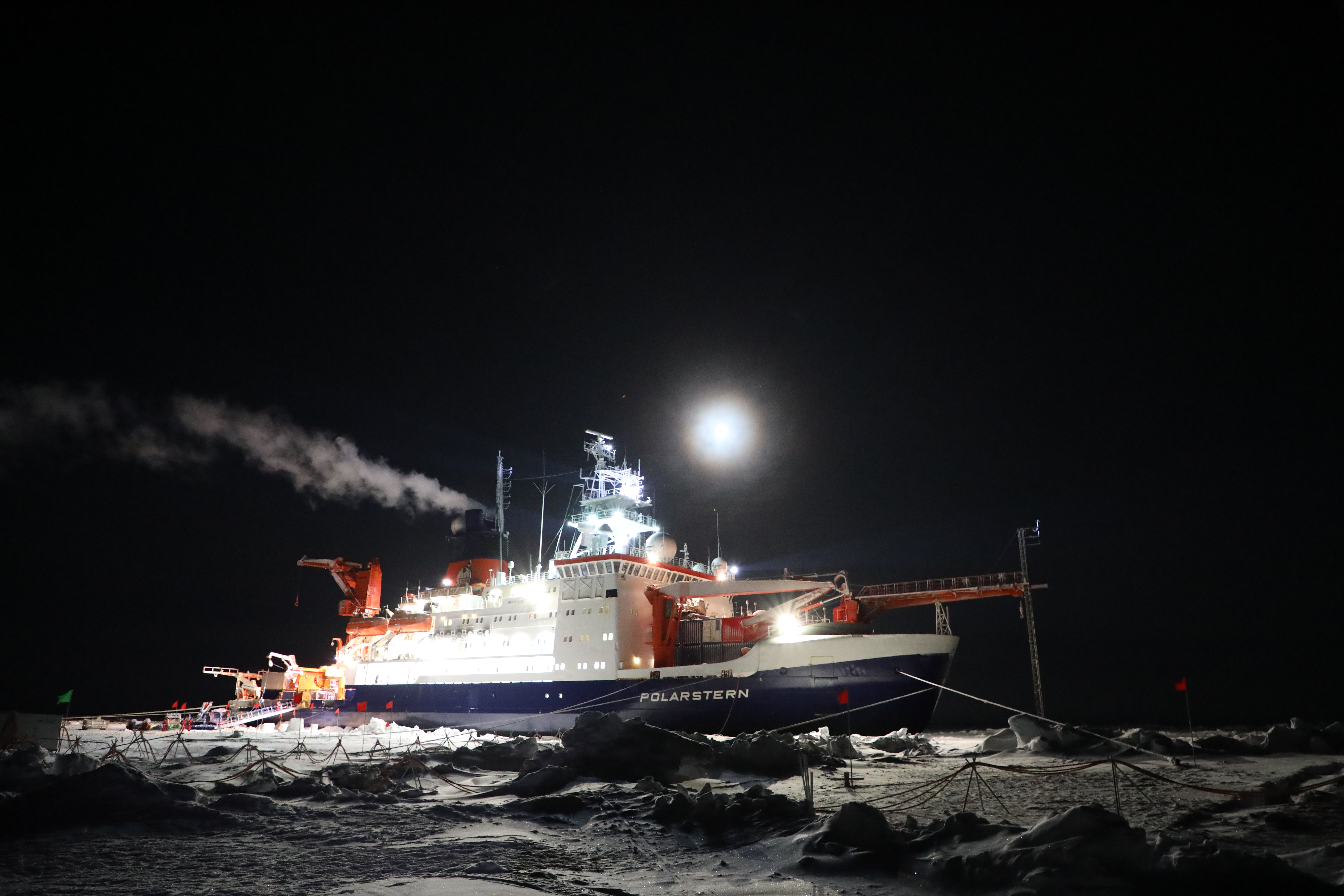
From September 2019 to October 2020, ARM instruments on the research vessel Polarstern collected continuous atmospheric data during the Multidisciplinary Drifting Observatory for the Study of Arctic Climate (MOSAiC) expedition.
Four years ago, the pandemic had the world in a nervous tailspin, with disrupted travel, isolation, and an uncertain future. At that time, a group of scientists was stuck (literally) on a ship frozen into the central Arctic. While the sun was just arriving back after a four-month “polar night,” these scientists were waking up to the notion that they were not coming home on their planned schedule. Until a new travel plan could be designed, they would remain in the Arctic ice, ensuring continuous collection of important climate data to help us unravel the mysteries of rapid Arctic change.
This was the MOSAiC expedition, wherein the research vessel Polarstern drifted with the sea ice across the central Arctic from September 2019 to October 2020. Thanks to the valiant efforts of those scientists stuck in the ice, and the many others who came and went from the expedition over the full year, we now have one of the most valuable data sets to explore the intricate details and processes of the coupled Arctic atmosphere-ice-ocean system.
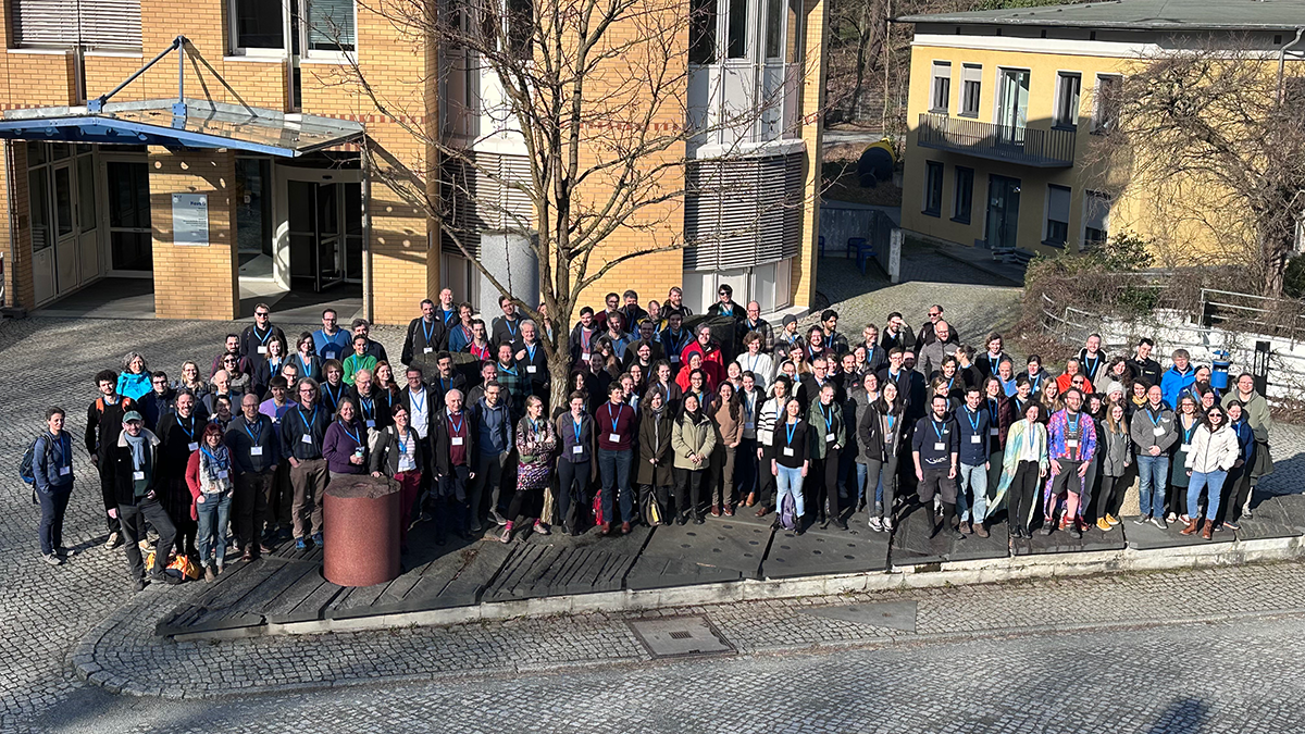
These data continue to fuel an explosion of scientific productivity, as captured by the 3rd MOSAiC Science Conference (3MSC) in Potsdam, Germany, from February 26 to March 1, 2024. I have been engaged in the MOSAiC journey for 15 years now … designing, proposing, planning, coordinating, implementing, and collaborating. It’s been a long and winding path with many challenges, but at the 3MSC, I was able to sit back and appreciate the magnificence of the whole thing, as conveyed through a broad range of cutting-edge science and the blossoming of a new generation of Arctic scientists.
We briefly stepped away from our exciting scientific activities to take a group photo during the 3rd MOSAiC Science Conference (3MSC) in Potsdam, Germany.
Conference Highlights
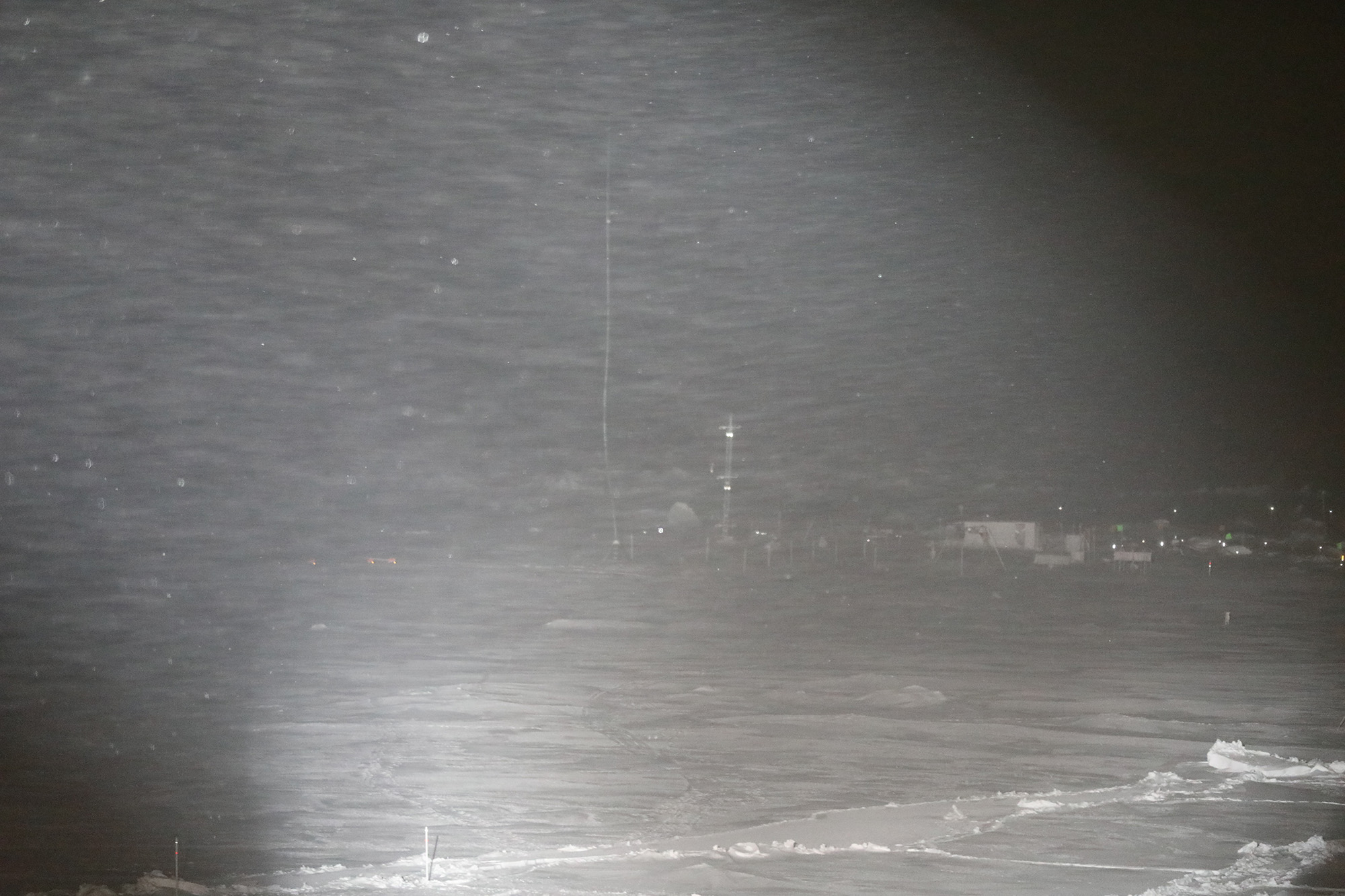
At the 3MSC, I heard a composition based on MOSAiC data from this November 2019 storm. Looking out from Polarstern toward the Met City installation on the sea ice, you can see a bunch of ARM meteorological instruments installed amid the blowing snow.
Most of the 3MSC sessions were interdisciplinary in nature, embodying a key goal of MOSAiC to explore the couplings and interactions that drive and respond to sea-ice decline. Sessions focused on themes such as chemical tracers in the Arctic system, atmosphere-ice-ocean interactions, the distribution and fate of sunlight, the role of sea-ice leads and ridges, and upscaling and downscaling of information.
It was great to see the prominent role of early career scientists in presenting their science and leading sessions. Importantly, many of the large, collaborative cross-cutting scientific activities are being led by these new scientists, tackling broad topics such as the sources and impacts of freshwater, the thermal properties of sea ice, and the seasonal composition of the atmosphere. MOSAiC has helped to promote a whole new generation of Arctic scientists.
The 3MSC also attracted many attendees who did not participate in the field activities. The MOSAiC community continues to grow as new users are drawn to these fantastic data sets. In particular, many modeling activities were represented, ranging from detailed large-eddy simulation studies of clouds to representations of biogeochemical processes to evaluation of nudged climate model simulations, with many activities in between.
Data from the U.S. Department of Energy (DOE) Atmospheric Radiation Measurement (ARM) user facility had their fingerprints on the conference, supporting a growing user community. ARM data underpin a bounty of new knowledge on central Arctic aerosols and their processes. The data are used to characterize cloud properties, force cloud model simulations, and drive radiative transfer calculations. These data have found their way into numerous model assessments and the verification of satellite observations. They are used to quantify snowfall over the sea ice and characterize the atmospheric boundary-layer structure and its evolution.
Another highlight was the conference dinner at an old movie house, where attendees shared in food, drinks, conversation, and a wide collection of videos from the field. In one theater, I experienced a unique project wherein a team of artists built a music system that looked like an organ and “played” MOSAiC data! The composition was based on data from a mid-November 2019 storm that I personally experienced while in the field. It was certainly a new and very abstract way to experience the data, but oddly, it captured the intensity and chaos of that stormy time out in the darkness of the central Arctic sea ice. This was just one indicator of the breadth of MOSAiC’s impact, which continues to grow.
This is the second blog from AMSG Co-Chairs Gannet Hallar and Tim Onasch.
AMSG promotes ARM’s Fiscal Year 2024 Aerosol Operations Plan
Gannet Hallar, left, and Timothy Onasch
Hello, and welcome to the AMSG blog! We are here to provide an update on ARM-related work based, in part, on recommendations from the AMSG.
As we wrote in our first blog, the AMSG is a constituent group tasked by ARM to enhance the scientific impacts of its aerosol measurements. Our specified actions to accomplish this goal include:
increasing outreach and coordination, specifically to and with external and international communities and networks
assisting ARM in developing a new Aerosol Measurement Plan (the last one was published in 2018)
organizing another strategic planning workshop to map out future AMSG activities.
In this blog, we highlight the release of a new ARM Aerosol Operations Plan (AOP). This plan, which ARM intends to update and publish yearly, represents the culmination of AMSG actions and recommendations (i.e., No. 2 in the list above). We are excited to see ARM activities driven, in part, by AMSG guidance.
The fiscal year 2024 (FY2024) AOP can be found here on ARM.gov.
Key Components of ARM’s New AOP
The FY2024 AOP is actually the second plan from ARM directly relating to aerosol measurements, with the 2018 Aerosol Measurement Plan being the first. The 2018 plan focused on capability development priorities, whereas the new plan covers both development and operational priorities.
We are very excited to see ARM develop such a detailed AOP and commit to generating updates every fiscal year. This plan will help communicate ARM operations and provide the science communities with a transparent schedule.
We highlight some of the main components of the FY2024 AOP here:
updates on progress relating to tasks from the 2018 ARM Aerosol Measurement Plan
alignment of ARM aerosol measurement needs with changing ARM-related science/technology, including new measurement capabilities, such as more robust and available ice nuclei and particle number flux measurements
creation of an ARM operations calendar for aerosol instrument calibrations and service, which provides the framework for providing “best-case” conditions for user-led campaigns or intensive operational periods (IOPs) at ARM sites (the calendar is a direct ARM response to the IOP framework introduced by us [Gannet and Tim] during the 2019 AMSG strategic planning workshop)
development of aerosol nodes (i.e., small, remote sites instrumented with inexpensive instruments to augment standard ARM Aerosol Observing System sites to address spatial and temporal variabilities in point source measurements)
deployment of additional aerosol instrumentation to the North Slope of Alaska atmospheric observatory in partnership with NOAA, which has historically made aerosol measurements at the site and provided them to ARM.
Engage With Us
As members of various atmospheric science communities ourselves, we are always looking for scientific input, feedback, and suggestions for improvement. The DOE ARM infrastructure is a fantastic resource that seeks continual guidance from interested scientific communities, and the AMSG represents one way for aerosol scientists to interact and help build a successful future.
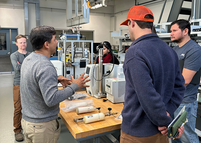
In addition to being trained on a set of aerosol instruments that will be deployed in Tasmania, ARM site operators received a lesson from instrument mentor Ashish Singh (left) on how to use the scanning mobility particle sizer calibration system during their visit to the Center for Aerosol Measurement Science. Photo is by Olga Mayol-Bracero, Brookhaven National Laboratory.
CAPE-k, using components of the second ARM Mobile Facility (AMF2), will augment the ongoing measurements at Kennaook/Cape Grim Baseline Air Pollution Station on the northwestern tip of Tasmania, Australia, and will provide cloud and precipitation observations from a suite of ground-based remote sensors from mid-April 2024 through September 2025. For CAPE-k, ARM will deploy three instruments that are part of the ARM AOS: the aerodynamic particle sizer, the single-particle soot photometer, and the ultra-high-sensitivity aerosol spectrometer.
Led by Olga Mayol-Bracero, ARM AOS mentors from the Aerosol Observations Group in Brookhaven Lab’s Environmental and Climate Sciences Department organized the training at CAMS. It was a two-day training that included calibration and instrument maintenance aspects related to the three AOS CAPE-k instruments. CAMS operations funding is provided by the U.S. Department of Energy’s Office of Science as part of the ARM user facility.
In the closing discussions, the visiting site operators expressed how productive the training had been, and one of them said, “I learned more in two days at CAMS than I have in a whole year.”
The ARM AOS mentors at Brookhaven Lab plan to perform at least three more similar activities during 2024 to train the site operators for ARM’s Southern Great Plains and Bankhead National Forest atmospheric observatories and an upcoming campaign in Maryland, the Coast-Urban-Rural Atmospheric Gradient Experiment (CoURAGE). These training activities show the value of the new CAMS not only for calibrations but also for instrumentation training.
The application deadline is Wednesday, May 22, 2024, at 5 p.m. Eastern time.
Through SULI and CCI, undergraduate students discover science and technology careers at the DOE national laboratories and gain the experience needed to transition from internship to employment. Interns work directly with national laboratory scientists and engineers, assisting them on research or technology projects that support the DOE mission.
SULI is open to full-time students attending four-year institutions and community colleges or recent graduates within two years of receiving their bachelor’s degree, while CCI is exclusively for community college students. Both programs are stipend-based and offered three times annually in fall, spring, and summer.
Three workshops will be held for SULI and CCI (all times Eastern below). Two workshops will introduce the program and application process for each program, followed by the final workshop which will review the application process for each program before highlighting the research opportunities and internship experience at the DOE national labs through an alumni panel discussion.
CCI workshop: Wednesday, April 10, 2024, at 1:30 p.m. (register now)
SULI workshop: Tuesday, April 16, 2024, at 2 p.m. (register now)
SULI and CCI panel: Wednesday, April 24, 2024, at 1:30 p.m. (register now)
Potential mentors should reach out to SULI and CCI program contacts at their labs for information on how to request an intern.