Three members of the Atmospheric Radiation Measurement (ARM) User Facility and Atmospheric System Research (ASR) research communities were honored at the 2024 American Geophysical Union (AGU) Annual Meeting in Washington, D.C.
New AGU Fellow
Robert “Rob” Wood. Photo is courtesy of the University of Washington.
Robert “Rob” Wood, a professor of atmospheric and climate science at the University of Washington, was one of 54 researchers chosen as a 2024 AGU Fellow. Each year, AGU selects no more than 0.1% of its members for fellowship honors, which are awarded to individuals who have made exceptional contributions to earth and space science through a breakthrough, discovery, or innovation in their field.
Wood’s research explores the complex physics of clouds, particularly low clouds, and the intricate cloud-aerosol interactions that influence cloud properties. He has led past ASR projects studying low clouds over ocean and land.
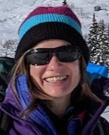
Jessica D. Lundquist. Photo is courtesy of Lundquist.
Jessica D. Lundquist, a snow hydrologist also at the University of Washington, was recognized as a 2024 AGU Ambassador Award recipient. The award is given annually to a small number of honorees whose outstanding contributions and achievements extend beyond those recognized by traditional scientific discipline awards.
Lundquist led a recent campaign that partnered with ARM’s Surface Atmosphere Integrated Field Laboratory (SAIL) campaign, which operated from 2021 to 2023 near Crested Butte, Colorado. The National Science Foundation-funded Sublimation of Snow (SOS) campaign operated concurrently with SAIL and sought to help researchers better understand snow sublimation, the process in which water molecules transfer directly from ice crystals to water vapor, bypassing the intermediate liquid state.
In November 2023, Lundquist joined with Daniel Feldman, SAIL’s principal investigator, and Gijs de Boer, who led another SAIL partner campaign—the NOAA-funded Study of Precipitation, the Lower Atmosphere and Surface for Hydrometeorology (SPLASH)—for a collaborative workshop. The three scientists brought together their respective campaign teams to talk data, find common ground on research themes, and learn about ongoing work and desired outcomes. In continuation of these ongoing collaborative efforts, a second session of the workshop was held in early January 2025.
Atmospheric Sciences Section Award
Manabu Shiraiwa. Photo is courtesy of Shiraiwa.
Manabu Shiraiwa, a chemistry professor at the University of California, Irvine, received a 2024 Ascent Award. Presented by AGU’s Atmospheric Sciences Section, the award is given annually to four midcareer scientists (who are within eight and 20 years of receiving their PhDs) for their excellence in research and leadership within the atmospheric and climate sciences.
Shiraiwa’s research focuses on kinetic modeling of multiphase processes of atmospheric organic aerosols. He delves into the physical properties and chemical processes of aerosols to better understand their effects on atmospheric chemistry, air quality, and human health.
AGU is now accepting nominations for 2025 section and union honors. The 2025 AGU Annual Meeting is scheduled for December 15 to 19 in New Orleans, Louisiana.
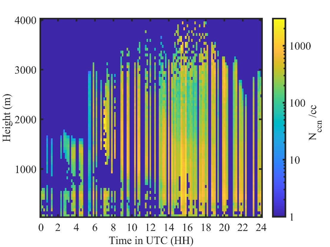
This sample plot from ARM’s Eastern North Atlantic atmospheric observatory shows the retrieved number concentration of cloud condensation nuclei at 0.4% supersaturation for April 1, 2023. Data plot is by Gourihar Kulkarni, Pacific Northwest National Laboratory.
The Retrieved Number concentration of Cloud Condensation Nuclei value-added product (RNCCN VAP) is now available for evaluation for the Eastern North Atlantic (ENA) atmospheric observatory. This VAP provides the vertical distribution of cloud condensation nuclei (CCN) number concentrations at Atmospheric Radiation Measurement (ARM) User Facility sites for better representation of aerosol indirect effects in climate models.
RNCCN gives users the retrieved vertical profiles of CCN concentrations at the various supersaturation values measured by one- and two-column versions of the CCN particle counter. (Supersaturation occurs when the relative humidity is at least 100%.) RNCCN also routinely provides retrieved values of CCN near cloud base, which is a proxy for the aerosol that is entrained into clouds and leads to droplet formation.
The VAP uses a hygroscopicity parameter (gamma) based on the Hänel (1976) parameterization to calculate extinction changes due to hygroscopic growth of aerosol. Hygroscopicity is the ability of a particle to take up moisture from the environment and is important for understanding the variation in lidar-derived extinction with altitude.
For input, the VAP uses quality-controlled Raman lidar profiles (aerosol extinction and feature mask) and CCN spectral data in addition to the hygroscopicity data.
The ENA RNCCN evaluation data are available from January 20, 2017, to October 31, 2023. The data have 1-hour time resolution and 60-meter vertical resolution, and they are in netCDF format.
More information about the VAP, including its technical report, is available on the RNCCN web page.
Scientists can use RNCCN to help improve understanding of aerosol-cloud interaction treatment in global earth system models. Future work will involve extending this product to ARM’s Bankhead National Forest observatory in Alabama. The VAP team also plans to apply new quality control tests to further improve the data quality.
To provide feedback or ask questions about the evaluation data, please contact VAP science mentor Gourihar Kulkarni, VAP developer Chitra Sivaraman, or ARM aerosol translator John Shilling.
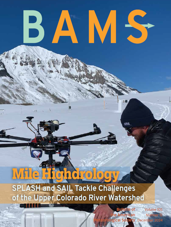
The December 2024 print issue of the Bulletin of the American Meteorological Society (BAMS) features uncrewed aerial system pilot Jonathan Hamilton (wearing an ARM-branded beanie), a HELiX hexacopter, and a set of instruments at Kettle Ponds, Colorado. The HELiX and ground-based instruments all collected data for a NOAA study that partnered with ARM’s Surface Atmosphere Integrated Field Laboratory (SAIL) campaign to glean information about processes that affect mountain hydrology. Photo is by Gijs de Boer, Brookhaven National Laboratory, formerly at the University of Colorado Boulder.
In its December 2024 print issue, the Bulletin of the American Meteorological Society (BAMS) spotlighted the recent Surface Atmosphere Integrated Field Laboratory (SAIL) campaign conducted in Colorado by the Atmospheric Radiation Measurement (ARM) User Facility.
The cover photo, taken by scientist Gijs de Boer in March 2022, features uncrewed aerial system pilot Jonathan Hamilton wearing an ARM-branded beanie at the snow-covered Kettle Ponds site. In the photo, Hamilton looks at data from a rotary-wing HELiX hexacopter while ground-based instruments collect measurements nearby for NOAA’s Study of Precipitation, the Lower Atmosphere and Surface for Hydrometeorology (SPLASH).
Led by de Boer, SPLASH ran in conjunction with the SAIL campaign, which operated from September 2021 to June 2023 in the East River Watershed near Crested Butte. Scientists are using data from SAIL, SPLASH, and other partner campaigns and projects in the region to improve understanding and modeling of processes that affect mountain hydrology.
In that vein, the BAMS cover features the words “Mile Highdrology” and “SPLASH and SAIL Tackle Challenges of the Upper Colorado River Watershed” underneath.
Hamilton, an associate scientist from the Cooperative Institute for Research in Environmental Sciences at the University of Colorado Boulder, was on the SPLASH team. Data collected by the HELiX provided details on the spatial distribution of surface reflectivity and surface characteristics during spring melt.
The issue features abridged versions of previously published SAIL and SPLASH campaign overview papers. BAMS published both papers early online in 2023.
Editor’s note (January 9, 2025): Registered attendees can watch all recorded content and access the virtual poster gallery via the online meeting platform until February 28, 2025.
The 2024 American Geophysical Union (AGU) Annual Meeting will be held from December 9 to 13 at the Walter E. Washington Convention Center in Washington, D.C., as well as online. With more than 25,000 attendees expected, the meeting might feel overwhelming. We make it easy for you to find ARM-relevant science, meet up with colleagues, and discover new connections during the event.
Below is a list of ARM-related AGU meeting highlights (all times Eastern). Session/presentation IDs are subject to change; please check the AGU Annual Meeting website and download the meeting app for the most up-to-date information. Follow us on LinkedIn and Facebook for a real-time guide to relevant activities using the hashtags #ARMAGU and #AGU24.
Attending AGU in person? Make sure to visit the ARM booth (#338) and ASR at the U.S. Department of Energy’s (DOE) Office of Science Biological and Environmental Research (BER) program booth (#139) in the AGU exhibition hall. There you can view facility materials and meet with ARM and ASR representatives.
NEW for AGU 2024: Only plenary and keynote sessions will be live-streamed; named lectures, Union sessions, oral sessions, and town halls will be available for on-demand viewing only. Check the AGU schedule for more information.
CoURAGE Investigators’ Meeting
Lead scientist Ken Davis, Pennsylvania State University, will lead a Coast-Urban-Rural Atmospheric Gradient Experiment (CoURAGE) investigators’ meeting on Tuesday, December 10, from 4:30 to 6 p.m. in the Georgetown University room at the Marriott Marquis.
TH23A: A Discussion with Program Managers for Early-Career Scientists Tuesday, December 10, 12:30–1:30 p.m., Marquis 1–2 (Marriott Marquis) Primary Contact: Alyssa M. Stansfield, University of Utah Presenters: Alyssa M. Stansfield, University of Utah; Daniel Barrie, NOAA; Eric Thomas DeWeaver, National Science Foundation; Shaima Nasiri, DOE
TH23E: AmeriFlux Town Hall: What’s Next for AmeriFlux Science Tuesday, December 10, 12:30–1:30 p.m., Marquis 3–4 (Marriott Marquis) Primary Contact: Margaret S. Torn, Lawrence Berkeley National Laboratory Presenters: Daniel B. Stover, DOE; Sébastien Biraud, Trevor F. Keenan, You-Wei Cheah, and Leila Constanza Hernandez Rodriguez, Lawrence Berkeley National Laboratory; Dario Papale, University of Tuscia
TH25G: Building Trust in Science Through Relevance Before Crisis Strikes Tuesday, December 10, 6–7 p.m., Marquis 1–2 (Marriott Marquis) Primary Contact: Genoa Johnson, Pacific Northwest National Laboratory Presenters: Speakers planned from National Geographic, NASA, and Oak Ridge National Laboratory
TH45D: Developing a Community of Practice for Decision-Relevant Climate Data Products Thursday, December 12, 6–7 p.m., Marquis 1–2 (Marriott Marquis) Primary Contact: Renu Joseph, DOE Presenters: James M. Kuperberg, DOE; Kevin Hiers, U.S. Department of Defense; Daniel Barrie, NOAA; Paul Ullrich, Lawrence Livermore National Laboratory; Daniel Feldman, Lawrence Berkeley National Laboratory
ARM-Related Presentations
Oral Presentations
Please note: On average, each oral presentation is scheduled to run no longer than fifteen minutes, so full session times are listed below for planning purposes.
Please note: On average, each presentation is scheduled to run no longer than fifteen minutes, so the full session times are listed below for planning purposes.
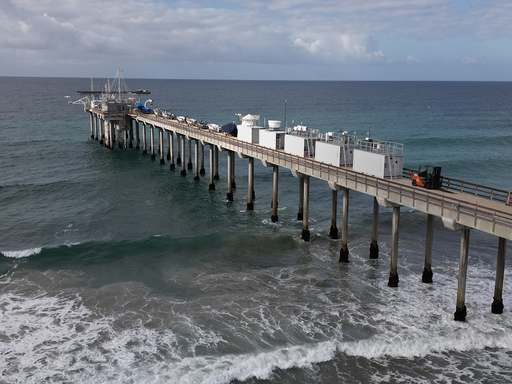
An ARM Mobile Facility operated on the Ellen Browning Scripps Memorial Pier in La Jolla, California, as part of the Eastern Pacific Cloud Aerosol Precipitation Experiment (EPCAPE). Photo is by Gregory Roberts, Scripps Institution of Oceanography.
The Eastern Pacific Cloud Aerosol Precipitation Experiment (EPCAPE), which kicked off in La Jolla, California, in February 2023 and ran through February 2024, explored aerosol indirect effects on stratocumulus clouds to help improve their representation in earth system models. EPCAPE included the deployment of an ARM mobile observatory on the Ellen Browning Scripps Memorial Pier and a scanning cloud radar on Mount Soledad less than a mile inland.
Using data collected during EPCAPE, researchers will explore how pollution from the nearby Los Angeles metropolitan area affects marine aerosols and, by extension, the clouds near San Diego.
Surface Atmosphere Integrated Field Laboratory (SAIL)
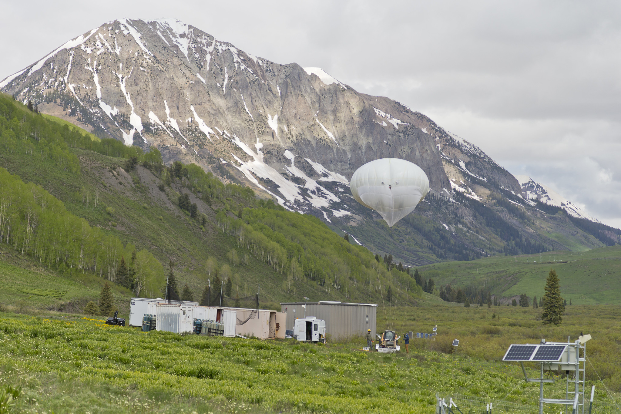
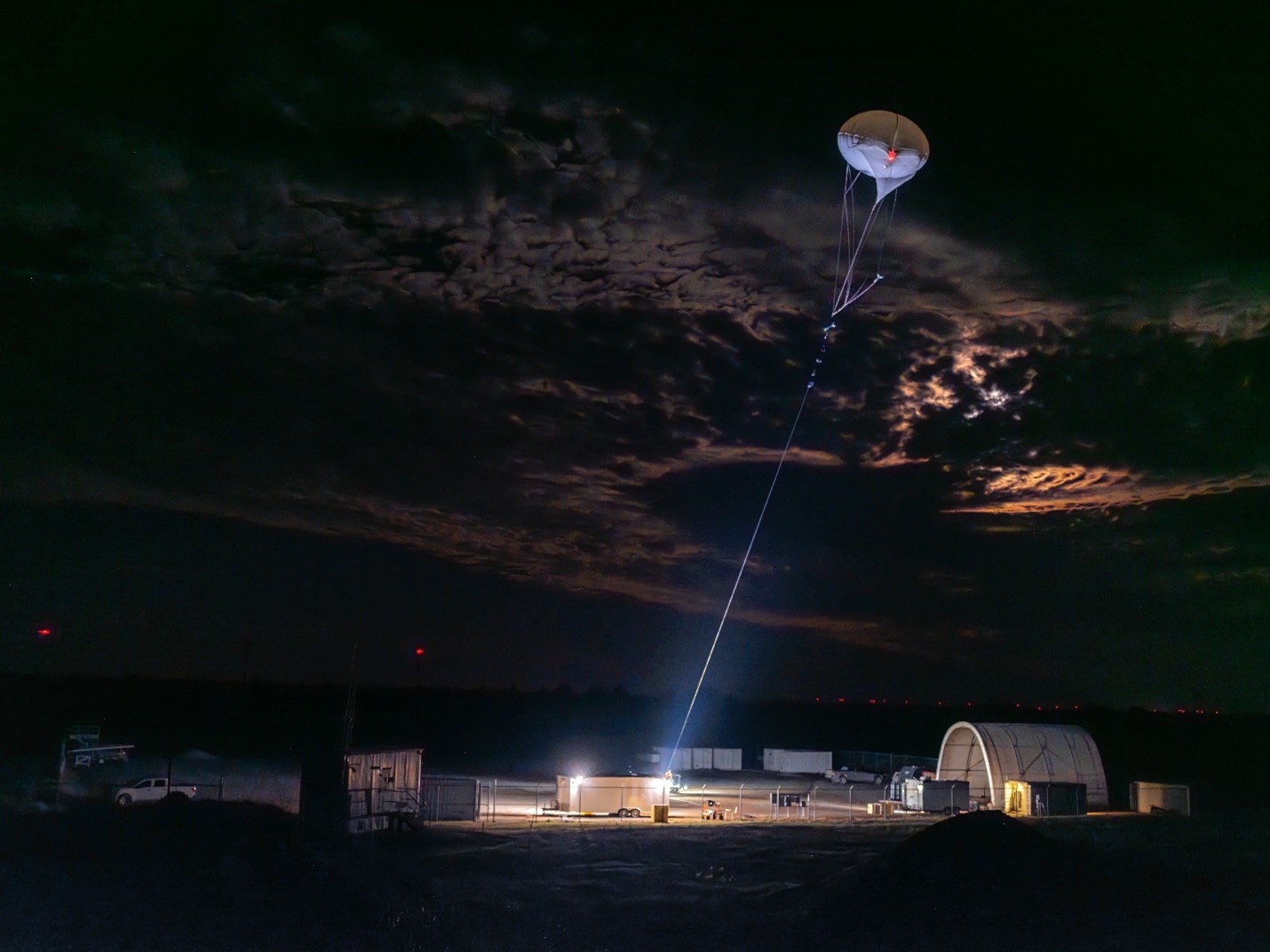
ARM’s tethered balloon system (TBS) and TBS instrument trailer are pictured during the Surface Atmosphere Integrated Field Laboratory (SAIL) field campaign near Crested Butte, Colorado. Photo is by Nathan Bilow.
The Surface Atmosphere Integrated Field Laboratory (SAIL) field campaign, which operated from September 2021 to June 2023, took place in the 300-square-kilometer (116-square-mile) East River Watershed near Crested Butte, Colorado. As part of SAIL, an ARM mobile observatory provided valuable atmospheric data that researchers can use to develop detailed measurements of mountainous water-cycle processes pertaining to the Colorado River, which supplies water for 40 million people in the Western United States.
Through SAIL, researchers from national laboratories, universities, research centers, and agencies will enable an atmosphere-through-bedrock understanding of mountainous water cycles.
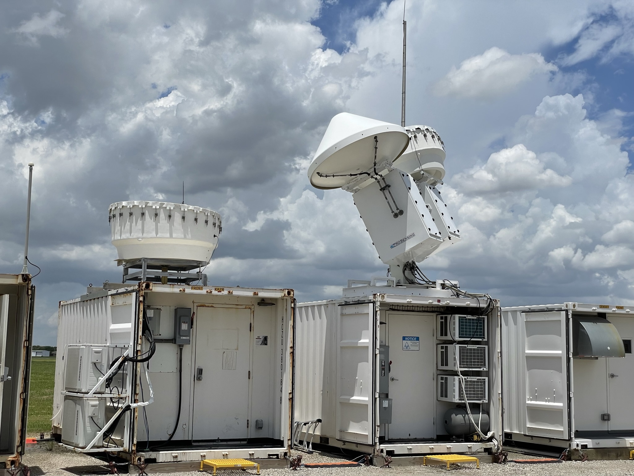
ARM radars capture cloud data in La Porte, Texas, during the TRacking Aerosol Convection interactions ExpeRiment (TRACER). ARM file photo.
The TRacking Aerosol Convection interactions ExpeRiment (TRACER), which ran from October 2021 through September 2022, provided convective cloud observations with high space and time resolution over a broad range of environmental and aerosol conditions around the Houston, Texas, region.
As part of TRACER, ARM deployed an ARM mobile observatory southeast of downtown Houston, a scanning precipitation radar south of downtown, and an ancillary site southwest of the city, where tethered balloon systems were launched. Together, these ARM measurements are helping researchers better understand the variability of aerosols and meteorology between the urban Houston area and surrounding rural environments.
Multidisciplinary Drifting Observatory for the Study of Arctic Climate (MOSAiC)
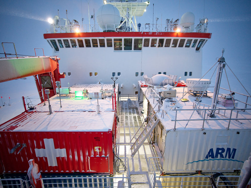
For the Multidisciplinary Drifting Observatory for the Study of Arctic Climate (MOSAiC) expedition, ARM deployed more than 50 instruments, including these operating from the bow of the R/V Polarstern. Photo is by Michael Gutsche, Alfred Wegener Institute (CC BY 4.0).
The massive Multidisciplinary Drifting Observatory for the Study of Arctic Climate (MOSAiC) expedition set out to document the atmosphere, sea ice, ocean, biogeochemistry, and ecosystem in the central Arctic. More than 400 field participants and 60 institutions from 20 countries were active in the German-led expedition from September 2019 to October 2020. MOSAiC’s central observatory was the icebreaker R/V Polarstern, which froze into and then drifted with the arctic sea ice for most of the year. ARM provided the most atmospheric instruments—more than 50—to the expedition.
The 2025 American Meteorological Society (AMS) Annual Meeting will be held from Sunday, January 12, to Thursday, January 16, at the Ernest N. Morial Convention Center in New Orleans, Louisiana, and online. With more than 7,000 attendees expected, the meeting might feel overwhelming. We make it easy for you to find ARM-relevant science, meet up with colleagues, and discover new connections during the event.
Below is a list of ARM-related AMS meeting highlights (all times Central). Information is subject to change; please check the AMS Annual Meeting website for the most up-to-date information.
Attending AMS in person? Make sure to visit the ARM table (#51) at the Career Resource and Graduate School Fair on Saturday, January 11, from 5 to 7 p.m. in Hall C (open to Student Conference attendees only), and Sunday, January 12, from 6:30 to 8:30 p.m. in Hall B (open to all AMS attendees).
U.S. Department of Energy (DOE) Updates
Agency Updates Session: DOE Plans for Atmospheric Research on Ships of Opportunity Monday, January 13, 12:15–1:15 p.m., Room 226 (Convention Center) Session Chair: Shaima Nasiri, DOE Presenters: Shaima Nasiri, DOE; Raghavendra Krishnamurthy, Pacific Northwest National Laboratory; Lynn M. Russell, University of California, San Diego; Derek Coffman, NOAA
Please note: On average, each oral presentation is scheduled to run no longer than 15 minutes, so full session times are listed below for planning purposes.
Please note: On average, each presentation is scheduled to run no longer than 15 minutes, so the full session times are listed below for planning purposes.
In June 2023, instruments along the Ellen Browning Scripps Memorial Pier collect measurements in the first of two intensive operational periods (IOPs) during the Eastern Pacific Cloud Aerosol Precipitation Experiment (EPCAPE) in La Jolla, California. Photo is by Nathan Wales, Los Alamos National Laboratory.
The Eastern Pacific Cloud Aerosol Precipitation Experiment (EPCAPE), which kicked off in La Jolla, California, in February 2023 and ran through February 2024, explored aerosol indirect effects on stratocumulus clouds to help improve their representation in earth system models. EPCAPE included the deployment of an ARM Mobile Facility on the Ellen Browning Scripps Memorial Pier and a scanning cloud radar on Mount Soledad less than a mile inland.
As part of EPCAPE, researchers will explore how pollution from the nearby Los Angeles metropolitan area affects marine aerosols and, by extension, the clouds near San Diego.
ORAL SESSION—J5A: Aerosol-Cloud Interactions in Warm Clouds I Joint session with the 17th Symposium on Aerosol Cloud Climate Interactions and the Second Symposium on Cloud Physics Tuesday, January 14, 8:30–10 a.m., Room 215 (Convention Center) Reported EPCAPE presentations:
Surface Atmosphere Integrated Field Laboratory (SAIL)
In June 2023, technicians launch a tethered balloon system (TBS) in Gothic, Colorado, toward the end of the 21-month Surface Atmosphere Integrated Field Laboratory (SAIL) campaign. Photo is by Nathan Bilow.
The Surface Atmosphere Integrated Field Laboratory (SAIL) field campaign, which operated from September 2021 to June 2023, took place in the 300-square-kilometer (116-square-mile) East River Watershed near Crested Butte, Colorado. As part of SAIL, an ARM mobile observatory provided valuable atmospheric data that researchers can use to develop detailed measurements of mountainous water-cycle processes pertaining to the Colorado River, which supplies water for 40 million people in the Western United States.
Through SAIL, researchers from national laboratories, universities, research centers, and agencies are gaining an atmosphere-through-bedrock understanding of mountainous water cycles.
ePOSTER SESSION—Wednesday ePosters Wednesday, January 15, 3–3:40 p.m., Hall C (Convention Center) Reported SAIL presentation:
This supplemental site in Guy, Texas, collected tethered balloon system measurements and other ARM data as part of the 2021–2022 TRacking Aerosol Collection interactions ExpeRiment (TRACER). Photo is by Guy Tubbs.
The TRacking Aerosol Convection interactions ExpeRiment (TRACER), which ran from October 2021 through September 2022, provided convective cloud observations with high space and time resolution over a broad range of environmental and aerosol conditions in the Houston, Texas, region.
As part of TRACER, ARM deployed a mobile observatory southeast of downtown Houston, a scanning precipitation radar south of downtown, and an ancillary site southwest of the city, where tethered balloon systems were launched. Together, these ARM measurements are helping researchers better understand the variability of aerosols and meteorology between the urban Houston area and surrounding rural environments.
ORAL SESSION—J11A: R2O2R Activities and Testing Joint session with the 33rd Conference on Weather Analysis and Forecasting, the 29th Conference on Numerical Weather Prediction, and the 15th Conference on Transition of Research to Operations (15R2O) Wednesday, January 15, 1:45–3 p.m., Room 206 (Convention Center) Reported TRACER presentation:
Editor’s note (February 11, 2025): The calls below are both CLOSED.
Scientists can propose for new missions or request to analyze aerosol samples collected on flights
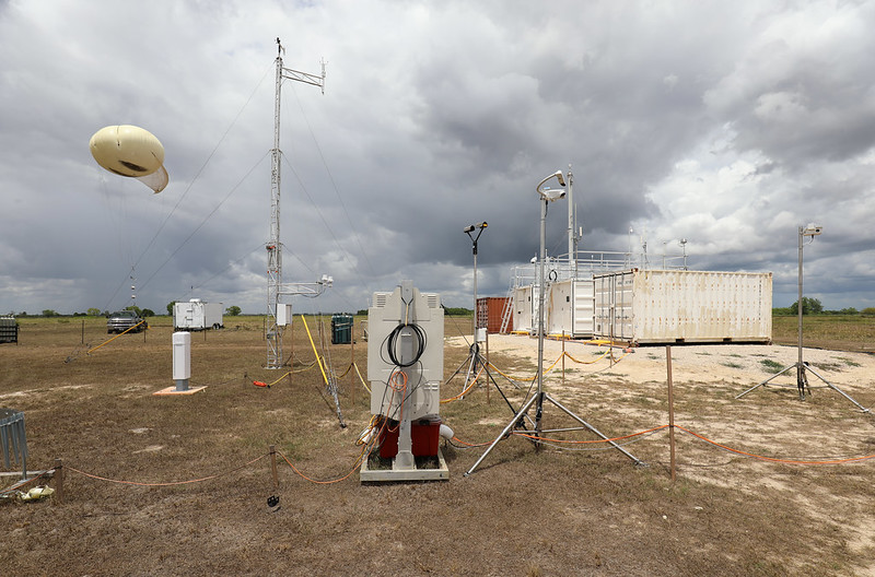
In June 2024, an ARM tethered balloon system flies in the early morning during a campaign at the Southern Great Plains atmospheric observatory in Oklahoma. Photo is by Brent Peterson, Sandia National Laboratories.
The Atmospheric Radiation Measurement (ARM) User Facility has two proposal calls open simultaneously for its tethered balloon systems (TBS).
For fiscal year 2026 (FY2026), ARM is now accepting preliminary proposals for TBS missions while also participating in a joint call with the Environmental Molecular Sciences Laboratory (EMSL). Like ARM, EMSL is a U.S. Department of Energy Office of Science user facility.
Through the new FICUS call, researchers can apply to use EMSL instruments to collect samples of aerosols and volatile organic compounds on ARM TBS flights and then conduct analysis using advanced laboratory techniques at EMSL. For information about the EMSL instruments available for this call, read the ARM/EMSL FICUS FY2026 solicitation.
FICUS submissions will require a letter of intent to facilitate the planning of the peer-review process, ensure alignment of proposals to ARM and EMSL missions and capabilities, and assist users in building strong proposals. More information about letter-of-intent requirements is available on this FICUS guidance web page.
The due date to submit preproposals for TBS missions through the ARM-only call is the same as the deadline to submit letters of intent for the FICUS call: Tuesday, February 4, 2025.
Get More Information: ARM TBS Webinar
For people interested in participating in either call and/or using TBS data in their research, ARM hosted a TBS webinar in January 2024. The webinar included information about ARM’s TBS capabilities and data. Watch the webinar recording now.
The Fiscal Year 2024 ARM Annual Report features images from the Cloud And Precipitation Experiment at kennaook (CAPE-k), which began in northwestern Tasmania in April 2024.
The Atmospheric Radiation Measurement (ARM) User Facility’s latest annual report is now available online. The report contains short articles summarizing facility activities in fiscal year 2024 (FY2024) plus eye-catching photos from ARM staff, users, and external contributors.
The report also highlights ARM infrastructure achievements, including the setup of the new Bankhead National Forest atmospheric observatory in Alabama, science flights of the ArcticShark uncrewed aerial system, and new data product releases and tool updates for the user community.
The Atmospheric Radiation Measurement (ARM) user facility and Atmospheric System Research (ASR) program area want to know about your presentations at the upcoming American Meteorological Society (AMS) annual meeting.
One of the best ways to draw attendees to your AMS presentations is to be highlighted on the ARM and ASR websites. If you or one of your team members will present a talk or poster during the 2025 AMS Annual Meeting—and if that presentation is based on your ASR-funded project or uses ARM data as a key data source—please submit your information by Friday, January 10.
We will publish your abstracts on the ARM and ASR websites, which serve as an important guide for attendees. We will also send an email to the ARM/ASR community to encourage their engagement with your presentation.
See the ARM and ASR presentations that have been shared so far for the AMS Annual Meeting, taking place Sunday, January 12, to Thursday, January 16, in New Orleans, Louisiana, and online.
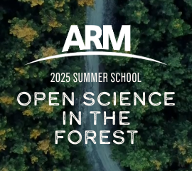
The Atmospheric Radiation Measurement (ARM) user facility will host an open science-focused summer school Monday, May 19, to Friday, May 23, 2025, at the University of Alabama in Huntsville.
The “Open Science in the Forest Summer School: Connecting State-of-the-Art Models with Diverse Field Campaign Observations” is geared toward students from undergraduates to postdoctoral scholars. Planned activities include instructional talks, tutorials, and mentored hackathon sessions for attendees to work with ARM data and open-source software.
The overarching mission of the summer school is to enhance the scientific impact of ARM observations through the instruction of students in new techniques to gain insight into atmospheric processes using open science tools.
Objectives of the summer school are to:
increase knowledge about the range of ARM observations, demonstrate innovative and methodologically sound use of those observations, and connect students to a variety of knowledgeable resources (e.g., ARM instrument mentors)
introduce students to resources within ARM for high performance data-proximate computation
equip students with a variety of techniques for comparing high-resolution model output with ARM observations to study a range of atmospheric processes.
Editor’s note (December 2, 2024): The story below originally published November 26, 2024. The Coast-Urban-Rural Atmospheric Gradient Experiment (CoURAGE) began official data collection December 1. See what data are now available in the ARM Data Center.
In and around Baltimore, Maryland, scientists, technicians, and students are poised for a year of measuring an urban atmosphere
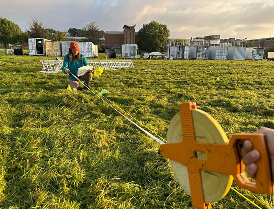
Krista Matuska, a postbaccalaureate researcher from Los Alamos National Laboratory from New Mexico, helps set up the main ARM instrument site in Baltimore, Maryland, for the Coast-Urban-Rural Atmospheric Gradient Experiment (CoURAGE). Photo is by Juarez Viegas, Los Alamos National Laboratory.
Do you want more CoURAGE?
Atmospheric scientists do, especially those that study climate and weather patterns affecting urban areas around the world.
What they have in mind is CoURAGE, the Coast-Urban-Rural Atmospheric Gradient Experiment. This yearlong field campaign in and around Baltimore, Maryland, will begin data collection December 1, 2024.
CoURAGE’s principal investigator is Pennsylvania State University professor Kenneth Davis, who oversees a team of 27 co-investigators.
The source of the campaign’s core instrumentation is the U.S. Department of Energy’s (DOE’s) Atmospheric Radiation Measurement (ARM) user facility. Instruments will measure properties of clouds, aerosols, precipitation, and solar and infrared energy at multiple sites.
Earth system models are not yet well adapted to predict climate and weather variability in cities. In part, that’s because robust, coordinated, and continuous field data in urban environments are hard to find.
CoURAGE was designed to help address this gap by taking detailed observations in and around Baltimore for a full year.
Continuous Atmospheric Data
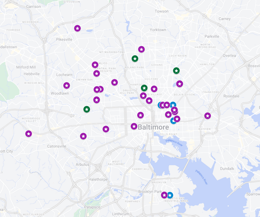
During CoURAGE, ARM’s deployed core and ancillary sites (red) will operate collaboratively with an existing regional network of atmospheric profiling and scanning radar stations (blue). Image is courtesy of Jason Horne, Pennsylvania State University.
CoURAGE and its city and regional partners will collect continuous atmospheric data from surface remote sensing instruments at four sites.
The main one, arrayed with instruments from an ARM Mobile Facility (AMF), is on the grounds of a former high school in Baltimore’s Clifton Park district. Three other sites will provide contextual city and upwind data: one urban, one rural, and one on Kent Island in Chesapeake Bay, an arm of the Atlantic Ocean.
All year, meanwhile, radiosondes launched at regular intervals will provide data on vertical dimensions of the urbanized atmosphere. ARM is also planning tethered balloon system flights during the campaign.
Research flights with non-ARM crewed aircraft will occur during CoURAGE’s two intensive operational periods, which are scheduled for winter and summer 2025.
CoURAGE-related collaborations by other research aircraft are pending, including possible contributions from NASA, the National Science Foundation, and the U.S. Naval Research Laboratory.
Scientific interest in the campaign is lively in other ways. On November 4, 2024, DOE announced a fiscal year 2025 funding opportunity through its Atmospheric System Research (ASR) program area. CoURAGE is one of the two research topics featured in the announcement. Pre-applications are due January 7, 2025.
Campaign Choreography
“When you are in theater and the show has to get out there, you have to drop stuff and make it happen. Field projects are the same way. You need to focus on the job and work together.”
The CoURAGE team seeks to measure the interconnected atmospheric components at play in urban environments. They include the nature of surfaces, aerosols, atmospheric chemistry, clouds, and patterns of precipitation.
Davis is an expert on the boundary layer, the first mile or so of the atmosphere. That’s where humanity resides, weather happens, and critical exchanges of water, energy, and wind-borne momentum take place between the Earth and thin shell of clouds and gases above it.
The science and the complex array of instruments from multiple partners can be a lot to coordinate.
Davis, who studied physics and choreography as an undergraduate at Princeton University, says he is grateful for the dance experience while planning CoURAGE.
“When you are in theater and the show has to get out there, you have to drop stuff and make it happen,” he says. “Field projects are the same way. You need to focus on the job and work together.”
An Urban Proxy
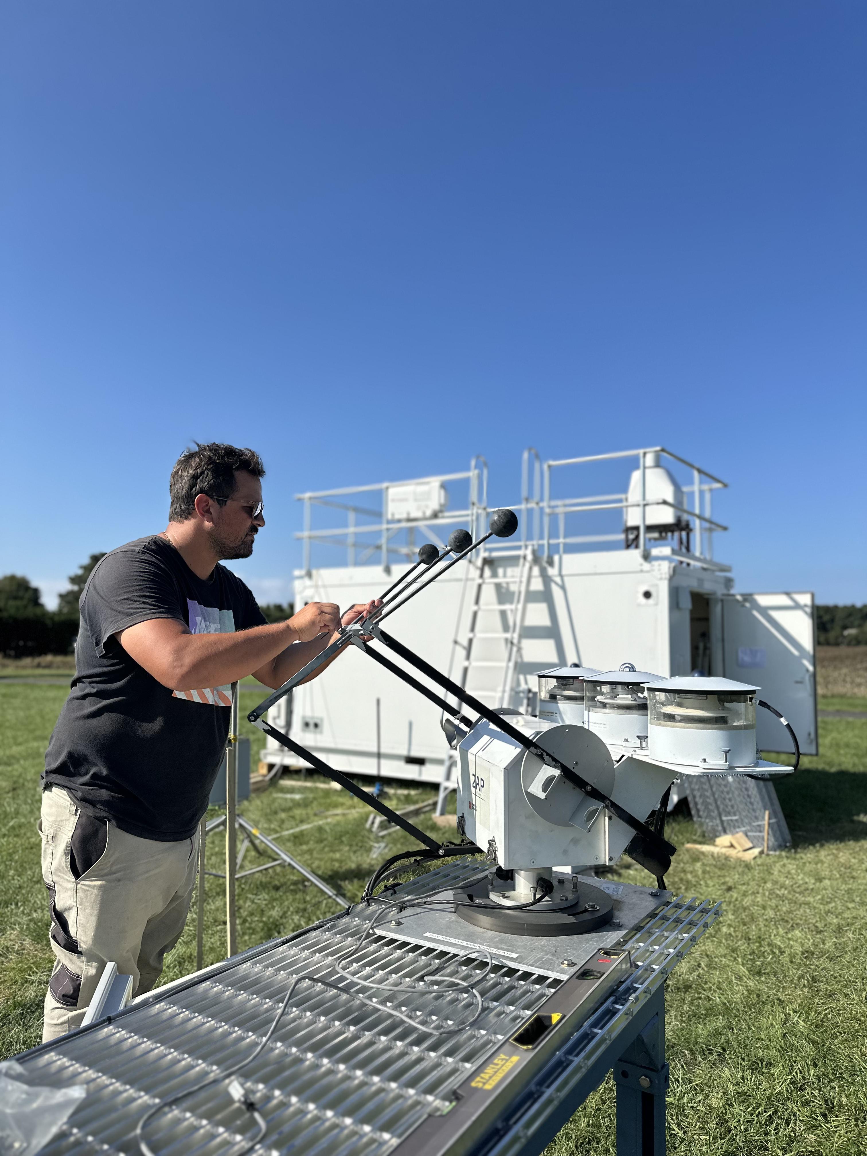
During the installation of ARM instruments on Kent Island, CoURAGE’s Chesapeake Bay site, Tercio Silva makes an adjustment to ARM radiometers. Silva is normally a site operator at ARM’s Eastern North Atlantic atmospheric observatory in the Azores. Photo is by Viegas.
CoURAGE is designed to improve model simulations of the urban atmospheric boundary layer, including its regional influences.
“This is supposed to serve all cities, not just Baltimore,” says Davis.
But why choose Baltimore for this campaign?
For one, the city, in combination with its neighboring rural and marine influences, represents atmospheric conditions that exist in many coastal urban centers in the Earth’s midlatitudes.
The open ASR funding call points to common topics of scientific interest in such areas. They include the need to better understand the impacts of city land use and sea and land breezes on regional temperatures, aerosols, clouds, precipitation, boundary-layer processes, and convective storm activity and intensity.
Cities and their surroundings influence regional climate and weather patterns in ways that models struggle to express. Satellite data suggest that urbanized areas of 50,000 people or more create downwind anomalies in precipitation that open land does not.
Cities also create their own weather, often at the scale of a square mile or less. Paved areas create heat islands that spike local temperatures. Canyon-like clusters of tall buildings alter wind patterns. Trees and other vegetation have cooling effects.
“It’s a complex environment,” says Davis. “That makes it challenging to get everything right. Interesting geographic locations like this also happen to be complex meteorologically.”
BSEC Beginnings
Davis was also attracted to Baltimore because of its human resources: a pre-existing consortium of community and university partners interested in the urban environment, from soils to atmosphere.
UIFLs reflect an increased interest among scientists in how a warming world will affect cities, as well as how future changes in weather and climate patterns will affect society.
One of the UIFLs is CoURAGE’s main partner: the Baltimore Social-Environmental Collaborative (BSEC), which Davis says made the ARM campaign possible by laying the groundwork for community engagement and relevant science questions.
BSEC’s proposal to become a UIFL was finished in June 2022 and awarded that fall.
Shortly after, in December 2022, DOE put out a call for proposals to deploy an AMF in an urban environment. It was intended to support the heightened interest of DOE’s Biological and Environmental Research program in the science of urban regions and their interactions with the climate system.
The CoURAGE proposal, motivated by the synergy of BSEC and the urban AMF call, says Davis, was finished in March 2023.
BSEC’s role is to generate “the climate science required for equitable climate action in Baltimore and beyond,” says its principal investigator, Ben Zaitchik, a Johns Hopkins University professor and CoURAGE co-investigator.
That means working with city officials and community to arrive at research questions and deploying the measurement systems needed to address those questions, he says. “CoURAGE is a powerful complement to those efforts.”
Community Weather Stations
This map shows the locations of Baltimore Social-Environmental Collaborative (BSEC) weather stations, which measure temperature, humidity, rainfall, wind, and sunlight. Colors show the type of instrument: purple for ambient weather; blue for OttHydro (for measuring and analyzing precipitation, surface water, and groundwater); and green for where both systems are combined. Map is courtesy of BSEC.
Some of the nearly 40 stations measure ambient weather conditions; some measure and analyze precipitation, surface water, and groundwater; and some stations measure both.
Most of the stations are at churches, schools, community gardens, and parks.
The data collected are comprehensive, says Waugh: neighborhood-scale measurements of “temperature and moisture of the air, rainfall, wind speed and direction, surface pressure, and the amount of sunlight—the kind of data needed to understand the causes and develop equitable solutions.”
Beyond the network of BSEC weather stations, only one National Weather Service station operates in Baltimore, in the Inner Harbor, he says. That is not enough to record how heat and other conditions vary across the city.
ARM’s CoURAGE measurements will provide additional detailed observations of aerosols, clouds, and atmospheric profiles to help understand the atmospheric processes driving the BSEC observations.
Baltimore experiences periodic “extreme heat, flooding, air pollution,” and more, says Zaitchik, who will serve as president-elect of the American Geophysical Union for the 2025–2026 term. “CoURAGE provides a unique suite of measurements that get at the atmospheric dynamics and chemistry behind these experiences.”
The campaign, he adds, will also “dramatically extend the kinds of science questions that BSEC is able to consider.”
Area Professionals
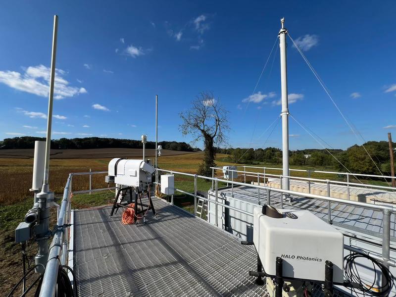
ARM instruments start to fill in CoURAGE’s rural site in Frederick County, Maryland, about 35 miles northwest of Baltimore. Photo is by Viegas.
Davis is grateful that CoURAGE is supported by BSEC’s commitment to community-engaged research.
“BSEC scientists regularly engage city stakeholders,” he says, including professionals from the Baltimore Office of Sustainability, the Baltimore City Department of Public Works, Old Goucher Community Association, and Maryland Department of the Environment (MDE).
An existing long-term observatory operated in Beltsville, Maryland, by MDE and Howard University will also supply CoURAGE data.
“CoURAGE will give MDE a better understanding of the three-dimensional feedback between the complex topography of the land-water-urban landscape and air quality,” said MDE air quality expert Joel Dreessen, “and how pollution and meteorology at the microscale result in intense gradients in air pollution, which can impact exposure and federal standard attainment in our region.”
Bringing in the Students
Most of all, CoURAGE is honey to busy-bee university students interested in science careers, including people from underrepresented groups.
Students from Morgan State and Howard—both historically Black universities—are involved in the campaign, as well as students from Johns Hopkins and Penn State.
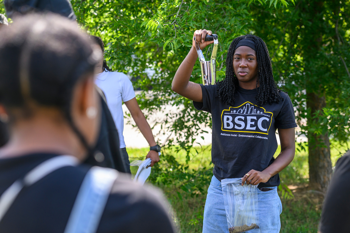
In July 2024, Johns Hopkins University undergraduate student Ariana Strasser-King, who is affiliated with BSEC, leads a soil sampling demonstration in Baltimore’s Howard Park neighborhood. Photo is by Travis Winstead III, Baltimore City College.
“CoURAGE is a great opportunity for Morgan State University students to participate, observe, and be inspired by a scientific operation with real-world impacts,” says Xiaowen Li, who leads the university’s climate studies program. She is also the lead scientist working to support ARM’s core site in Clifton Park, which is owned by Morgan State.
Li’s students will launch year-round weather balloons to contribute data to the campaign.
During CoURAGE, she says, “Campaign site visits will be part of our teaching in earth science-related courses”—so students can “develop exciting projects” that use live ARM data.
Morgan State students will also do outreach for CoURAGE. For example, two undergraduates will coordinate and conduct site visits for local communities and K-12 students.
“Finally,” says Li, “there are initiatives to involve students from (Morgan State’s) School of Global Journalism and Communication,” who will report on CoURAGE and climate.
‘An Exciting Time’
“As a young academic, being affiliated with a campaign of this magnitude is invaluable for research and networking.”
Imagine, too, the thrill of CoURAGE for Jason Horne, a PhD student working with Davis at Penn State.
“As a young academic, being affiliated with a campaign of this magnitude is invaluable for research and networking,” he says.
During CoURAGE, Horne will travel the few hours from school to Baltimore “as much as possible,” he says. “Being there in person is critical for understanding how operations look on the ground and engaging with community members.”
Horne also represents another important feature of CoURAGE: its monthly virtual science meetings, which bring together dozens of researchers across the country—many of them early in their careers—for updates and discussions.
Out of those meetings came an initiative that Horne helps guide: an urban modeling group “to advance the science of land-atmosphere interactions in the urban environment,” he says. “Conversations about modeling the urban environment are essential, and many people are working on the topic. Still, there are not many collaborations of this scale within the states. CoURAGE and (the UIFLs) mark a big first step.”
In the future, Horne wants to expand the conversation beyond the Baltimore campaign, domestically and internationally, and perhaps work toward a model intercomparison project and new proposals.
“Overall,” says Horne, “being a young academic in urban research is an exciting time.”


 The 2025 American Meteorological Society (AMS) Annual Meeting will be held from Sunday, January 12, to Thursday, January 16, at the Ernest N. Morial Convention Center in New Orleans, Louisiana, and online. With more than 7,000 attendees expected, the meeting might feel overwhelming. We make it easy for you to find ARM-relevant science, meet up with colleagues, and discover new connections during the event.
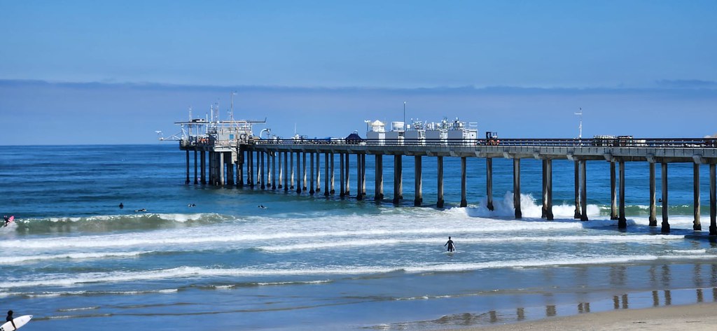

 The Atmospheric Radiation Measurement (ARM) user facility will host an open science-focused summer school Monday, May 19, to Friday, May 23,